Thursday, December 07, 2006

12/7 First Snow Flakes not out of the Question today

Just wanted to give people a heads up that this afternoon and evening may bring with it some snow showers, especially the further north you are. The western Slopes of the Mountains will see their first significant snows (3-6") and the higher Blue Ridge could see an inch or so.. the areas east of the mountains may also see their first few flakes. Longer term after a quick very cold shot tonight and tomorrow, a warmer/milder trend appears to be coming during next week!

All for now!

 
Mid Atlantic Weather: http://www.midatlanticweather.com
Mid atlantic Weather Forum: http://www.midatlanticweather.com/bb3


Access over 1 million songs - Yahoo! Music Unlimited.

Saturday, December 02, 2006


Colder air has arrived. Not quite as dramatic for immediate region but it was quite the snow depositor! My hopes of some snow have faded for the next week. Cold pattern holds a bit and then will break down! BTW.. Topped 70,000 all time hits today on Mid Atlantic Weather today! Thanks all!

Summary: Not a lot of time today. I just wanted to say we will get colder Monday and Tuesday, stay seasonably or slightly below through the end of the week and then the pattern appears to "Mild Up" to at or slightly above normal for a bit. Still need to keep an eye on the system close to the coast Monday. A cold rain at bets for far eastern spots, could see a quick mix in with sleet/snow... but nothing really.. at least that is the way I see it now. The other storm hope has all but disappeared!

Thanks to all who continue to post to the Forum. http://www.midatlanticweather.com/bb3/

Did You Know? I send this update out semi regularly via email! To get it send and email to midatlanticweather-subscribe@yahoogroups.com I also send a Severe Weather Alert when we need it. To get it mid-atlanticweather-subscribe@yahoogroups.com I am considering a tropical only list as well.

NEED a Great Host! Try Vodahost ! Their plan you cannot beat!!! 24000 MB of space, unlimited domains, unlimited email accounts, unlimited MySqL! HOW MUCH? $7.95 a month!!http://www.vodahost.com/partner/idevaffiliate.php?id=4524

WxAlliance is transforming the way that weather information is available for websites! If you need weather information in a quick and reliable way, WxAlliance will surpass your expectations! http://www.wxalliance.com

Forecast text and graphics from National Weather Service. Mid Atlantic Weather com is not responsible for accuracy of these forecasts and may not be held liable for any damages caused by using this web site. Data may not be current therefore the user agrees to always rely upon official forecast products for their area provided by the National Weather Service.

Friday, December 01, 2006

12/1 High Risk of severe weather Today

A very dynamic weather day is on tap which will include a brief period of Showers and Thunderstorms which will contain very gusty winds. The Winds will be topping 60 mph. There is also the threat for Isolated Tornadoes. A High Wind Warning is also in effect for just regular high winds exceeding 50 mph in gusts.
 
Please Stay Alert today as the risk of severe is higher than normal and we will already be dealing with just high winds in general.
 
All for now!

 
Mid Atlantic Weather: http://www.midatlanticweather.com
Mid Atlantic Weather Forum: http://www.midatlanticweather.com/bb3


Everyone is raving about the all-new Yahoo! Mail beta.

Wednesday, November 29, 2006


Colder air is coming this weekend with highs in the 40's! First, Severe Weather is possible Friday along with heavy rains and winds. There are hints of an early next week snow for MD/No VA/ Pennsylvania if a Coastal happens to form!

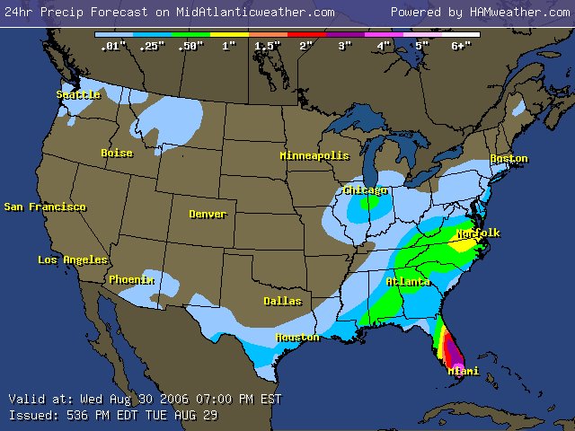
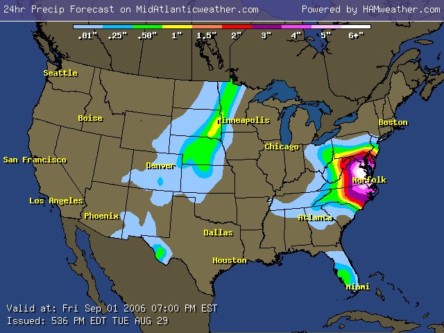
Summary: Chicago and just east down to Dallas Texas (Yes Texas.. The big D) are under the gun for a sloppy mix or a big thumping of snow. The front the Low Pressure is riding along will make it to our region Friday and cause heavy rains, high winds and potentially severe weather! Winds being the major threat in severe, but convection "Could" cause some storms to rotate! That could mean isolated tornadoes!

Colder air will be spreading over and holding in place through the the weekend as the front looks like it could stall along the coast! This "MAY" spawn a Low pressure and... well... that could mean snow for Northern VA, Maryland, and Pennsylvania! It is a bit of a far shot, but not as far as I thought it may be at one time!

As model runs come out and I get more Ideas don't forget to check the Forum! Also, feel free to comment on this Blog down at the bottom of this page!

For now the longer term stays cool with daytime highs in the 40s. There are yet other signs of true Arctic air visiting by next weekend! That is very far away at this point!

Thanks to all who continue to post to the Forum. http://www.midatlanticweather.com/bb3/

Did You Know? I send this update out semi regularly via email! To get it send and email to midatlanticweather-subscribe@yahoogroups.com I also send a Severe Weather Alert when we need it. To get it mid-atlanticweather-subscribe@yahoogroups.com I am considering a tropical only list as well.

NEED a Great Host! Try Vodahost ! Their plan you cannot beat!!! 24000 MB of space, unlimited domains, unlimited email accounts, unlimited MySqL! HOW MUCH? $7.95 a month!!http://www.vodahost.com/partner/idevaffiliate.php?id=4524

WxAlliance is transforming the way that weather information is available for websites! If you need weather information in a quick and reliable way, WxAlliance will surpass your expectations! http://www.wxalliance.com

Forecast text and graphics from National Weather Service. Mid Atlantic Weather com is not responsible for accuracy of these forecasts and may not be held liable for any damages caused by using this web site. Data may not be current therefore the user agrees to always rely upon official forecast products for their area provided by the National Weather Service.

Tuesday, November 28, 2006


Colder air while not be brutal for us but could be ushered in with some good rains. An eventual Mountain snowshower event. What about next week? +NAO does not favor a good East Coast Low. Maybe something to watch though

Summary: Nice weather countdown to more normal to slightly below for the weekend an into next week. The Front arrival on Thursday Night/Friday could trigger some stronger showers.. Maybe a storm? Being Dec 1 it is nice to see the temps trend a bit more season like, even a bit below!

Chicago may be spared the serious snows, but the Midwest will still see a significant Snow storm!

A disturbance could come close to the east coast next Tuesday/ Wednesday. Cold air would be available, but the storm may miss us and possibly graze New England? WAY TOO EARLY to tell and just a model thought now.

Thanks to all who continue to post to the Forum. http://www.midatlanticweather.com/bb3/

Did You Know? I send this update out semi regularly via email! To get it send and email to midatlanticweather-subscribe@yahoogroups.com I also send a Severe Weather Alert when we need it. To get it mid-atlanticweather-subscribe@yahoogroups.com I am considering a tropical only list as well.

NEED a Great Host! Try Vodahost ! Their plan you cannot beat!!! 24000 MB of space, unlimited domains, unlimited email accounts, unlimited MySqL! HOW MUCH? $7.95 a month!!http://www.vodahost.com/partner/idevaffiliate.php?id=4524

WxAlliance is transforming the way that weather information is available for websites! If you need weather information in a quick and reliable way, WxAlliance will surpass your expectations! http://www.wxalliance.com

Forecast text and graphics from National Weather Service. Mid Atlantic Weather com is not responsible for accuracy of these forecasts and may not be held liable for any damages caused by using this web site. Data may not be current therefore the user agrees to always rely upon official forecast products for their area provided by the National Weather Service.

Monday, November 27, 2006


It is only a matter of time, but colder air is going to work its way into the region starting this weekend! There are "Hints" at a possible overrunning Precipitation event next week. Longer term still shows potential for Some colder Air!

Summary: First I wanted to thank everyone who has posted to the Mid Atlantic Weather Forum! I am looking for return visits especially when winter weather is on the Horizon! Next, ENJOY THE WEATHER THE NEXT SEVERAL DAYS! We may see areas topping 70 in parts of the region! I am impressed by the Southeastern US Ridge which will slow the progression of the cold front that has started ushering in snow for the Washington Oregon and Upper Plains. As this low crosses the country it will slow and pump warm air into our region. The Front should clear our area by Friday. Over the Upper Midwest a serious snowstorm may occur in Chicago land. We will be in the 40's this weekend and then we will watch for a little something possible early next week. Another strong cold front may bring in yet colder air in the longer term!

Did You Know? I send this update out semi regularly via email! To get it send and email to midatlanticweather-subscribe@yahoogroups.com I also send a Severe Weather Alert when we need it. To get it mid-atlanticweather-subscribe@yahoogroups.com

NEED a Great Host! Try Vodahost ! Their plan you cannot beat!!! 24000 MB of space, unlimited domains, unlimited email accounts, unlimited MySqL! HOW MUCH? $7.95 a month!

http://www.vodahost.com/partner/idevaffiliate.php?id=4524

WxAlliance is transforming the way that weather information is available for websites! If you need weather information in a quick and reliable way, WxAlliance will surpass your expectations! http://www.wxalliance.com

Forecast text and graphics from National Weather Service. Mid Atlantic Weather com is not responsible for accuracy of these forecasts and may not be held liable for any damages caused by using this web site. Data may not be current therefore the user agrees to always rely upon official forecast products for their area provided by the National Weather Service.

It is only a matter of time, but colder air is going to work its way into the region starting this weekend! There are "Hints" at a possible overrunning Precipitation event next week. Longer term still shows potential for Some colder Air! First I wanted to thank everyone who has posted to the Mid Atlantic Weather Forum! I am looking for return visits especially when winter weather is on the Horizon! Next, ENJOY THE WEATHER THE NEXT SEVERAL DAYS! We may see areas topping 70 in parts of the region! I am impressed by the Southeastern US Ridge which will slow the progression of the cold front that has started ushering in snow for the Washington Oregon and Upper Plains. As this low crosses the country it will slow and pump warm air into our region. The Front should clear our area by Friday. Over the Upper Midwest a serious snowstorm may occur in Chicago land. We will be in the 40's this weekend and then we will watch for a little something possible early next week. Another strong cold front may bring in yet colder air in the longer term! All for now! OH BY THE WAY!!!! Links are being updated on the Mid Atlantic Weather Site Menu and Also the regional Sites! I NEED SITES! Email me at wxman@midatlanticweather.com Notice the Updated Winter Weather Links!

Sunday, November 26, 2006

11/25/2006: Cold Air set to arrive in a week. Enjoy the nice weather the next several days!

Not much more to share so I will just let this ride. Nice weather until about next Thursday. Much colder temps will arrive and even the possibility of snow? Maybe... much to watch in about a week! All for now!

---------------------------------------------------------------------------------------------
11/24 Increasing chances for a Serious cold shot next weekend! Snow? Still a question, but possible!! NICE 5-6 days ahead!

We will be under a Zonal Flow the next several days which will mean temps at or slightly above normal. Next Thursday a strong cold front is likely to come through and usher in much colder air! Highs Thursday may be in the mid 60's but Friday evening they may have plummeted to the lower 30s! The question that remains is whether or not the old air turns precipitation to a brief snow shower or even if a secondary wave of low pressure comes riding along that strong cold front and causes wintry precipitation! I am not sure. What does appear likely is that the cold air will be impressive, but only last 3 days at most! Highs may not get out of the 30's for 2 of the 3 days though! All for now!

Friday, November 24, 2006

11/24 DC/MD/VA Weather Outlook

Increasing chances for a Serious cold shot next weekend! Snow? Still a question, but possible!! NICE 5-6 days ahead!

We will be under a Zonal Flow the next several days which will mean temps at or slightly above normal. Next Thursday a strong cold front is likely to come through and usher in much colder air! Highs Thursday may be in the mid 60's but Friday evening they may have plummeted to the lower 30s! The question that remains is whether or not the old air turns precipitation to a brief snow shower or even if a secondary wave of low pressure comes riding along that strong cold front and causes wintry precipitation! I am not sure. What does appear likely is that  the cold air will be impressive, but  only last 3 days at most! Highs may not get out of the 30's for 2 of the 3 days though!

All for now!

 
Mid Atlantic Weather: http://www.midatlanticweather.com
Mid Atlantic Weather Forum: http://www.midatlanticweather.com/bb3

Thursday, November 23, 2006

11/23 DC/MD/VA Weather Outlook

HAPPY THANKSGIVING!!!! Rain moving slowly away and winds subsiding. Nice Weekend on tap and a mild pattern. Possible thunderstorms Wed -Thursday next week may signal a shift to colder! SNOW?
 
Summary: This Nor'easter did produce miserable conditions for many travelers the last 24 - 48 hours! Pockets of freezing rain were found in the Mountains. We will be mild and nice through about next Wednesday once this storm departs. Then things get interesting! A strong front could usher in much colder air and there are hints of a possible storm that may include snow for Interior sections, that weekend! Much too early to get specific!
 
Enjoy the Turkey and family today!!!
 
All for now!
 
 
Mid Atlantic Weather: http://www.midatlanticweather.com
Mid Atlantic Weather Forum: http://www.midatlanticweather.com/bb3


Everyone is raving about the all-new Yahoo! Mail beta.

Wednesday, November 22, 2006

12/22 DC/MD/VA Weather Outlook

A long Overdo, Weather Outlook: Strong Low moving up from teh SE to give winds and Rain to rgion for Turkey day. Warmer Weekend, and then signs a cool down? Or not?

Summary: A strong Low Pressure system off the SE coast will slowly push northward and increase rain coverage. A very cold and somewhat windy turkey Day looks on tap. After the Low departs we are left with a zonal flow across the nation. Average to even slightly above average temps for the weekend! Black Friday still could see some rain. Wondering what will be in Thursday's ads? Check this site http://bfads. net/ ! Amazing!

Long Term: There were signs that we could see some changes in the weather and even another sizable storm for the first weekend in December. This does not appear as likely to me.. Instead a continuation of Pacific Northwest rains (Seattle has hit there second Wettest Month in History) and somewhat mild weather should continue.

Today was impressive as the Earliest Snow ever fell in Charleston SC and even a Thundersnow which was the first reported for them as well!

All for now!
 
Mid Atlantic Weather: http://www.midatlanticweather.com
Mid atlantic Weather Forum: http://www.midatlanticweather.com/bb3


Sponsored Link


Mortgage rates near 39yr lows. $420,000 Mortgage for $1,399/mo - Calculate new house payment

Tuesday, November 21, 2006

11/21 DC/MD/VA Severe Weather Alert

Heavy Rains, highs winds, Mountain Snow?

Very heavy rains, High Winds, and even a taste of mountain snow (maybe) to affct us Tomorrow through Friday.
This is a very slow moving storm that cused snow in South Carolina today.... YES.. SOUTH CAROLINA!!! Charleston reported their earliest snow ever.. even a thundersnow!!! The storm will drop anywhere from 1-2 inches of rain and produce high winds especially east of I-95. The mountains MAY be able to eek a few hours of snow or sleet overnight tonight as the precipoitation makes its way into some colder air.

The weekend looks great after this passes..

MAYBE some colder air later next week! Storm??? Not sure!

** I will start regular updates again on my Web Site!!! Hoping to update and expand the winter section as well!

NEED A NINTENDO Wii? email me! wii@midatlanticweather.com

 
Mid Atlantic Weather: http://www.midatlanticweather.com
Mid atlantic Weather Forum: http://www.midatlanticweather.com/bb3


Sponsored Link


Mortgage rates as low as 4.625% - $150,000 loan for $579 a month. Intro-*Terms

Saturday, November 04, 2006


Now this is a quite the cold shot! 23 degrees last night and highs not out of the mid 40's yesterday! Now we will see a referral for about a week as the temps will rise. Winter Outlook looks potentially a bit colder than normal and above normal snow in the west and north... maybe a bit less at the coast

Summary: Long time since I last posted. Temperatures averaged quite a bit lower than normal for October and have continued into November! As a Strong low over the Gulf of Alaska re-aligns the jet stream, a strong warm up should occur for the country. We will average about 5 - 8 degrees above normal> the long term is showing a reversal in temps as high latitude blocking develops again (the needed mechanism for colder air to pure into the east). The snow cover has steadily increased and the trends would appear to be setting us up for a colder than normal winter.

Thanks to all who continue to post to the Forum. We have grown to 73 members! http://www.midatlanticweather.com/bb3/

Did You Know? I send this update out semi regularly via email! To get it send and email to midatlanticweather-subscribe@yahoogroups.com I also send a Severe Weather Alert when we need it. To get it mid-atlanticweather-subscribe@yahoogroups.com I am considering a tropical only list as well.

NEED a Great Host! Try Vodahost ! Their plan you cannot beat!!! 24000 MB of space, unlimited domains, unlimited email accounts, unlimited MySqL! HOW MUCH? $7.95 a month!!http://www.vodahost.com/partner/idevaffiliate.php?id=4524

WxAlliance is transforming the way that weather information is available for websites! If you need weather information in a quick and reliable way, WxAlliance will surpass your expectations! http://www.wxalliance.com

Forecast text and graphics from National Weather Service. Mid Atlantic Weather com is not responsible for accuracy of these forecasts and may not be held liable for any damages caused by using this web site. Data may not be current therefore the user agrees to always rely upon official forecast products for their area provided by the National Weather Service.

Sunday, October 08, 2006


Weather Roller Coaster AGAIN, as we warm early in the week and then plummet to much cooler temperatures. Severe Weather, high winds and even frosty temperatures could visit us in the next seven days!

Summary: Life is always crazy, but for me, it has been almost out of control! Is it ever really in control? Anyways, the weather will be a wild one this week. A Polar Vortex will become displaced and form a very strong system that could cause many areas in the Upper plains and around the lakes to see their first real accumulating snows! Not to mention a Severe weather threat and very high winds. This would affect us Thursday. Following the strong Front through here Thursday, temps could actually plummet during the day Friday and end up in the 40's by sunset for some and 30s in the mountains! West facing mountain snows would not be out of the question as well!

Tropics: Tropics are about done now! The likelihood will be that we are done with the Atlantic for the season! Not too bad compared to what was forecasted and what happened last year!

Thanks to all who continue to post to the Forum. http://www.midatlanticweather.com/bb3/

Did You Know? I send this update out semi regularly via email! To get it send and email to midatlanticweather-subscribe@yahoogroups.com I also send a Severe Weather Alert when we need it. To get it mid-atlanticweather-subscribe@yahoogroups.com I am considering a tropical only list as well.

NEED a Great Host! Try Vodahost ! Their plan you cannot beat!!! 24000 MB of space, unlimited domains, unlimited email accounts, unlimited MySqL! HOW MUCH? $7.95 a month!!http://www.vodahost.com/partner/idevaffiliate.php?id=4524

WxAlliance is transforming the way that weather information is available for websites! If you need weather information in a quick and reliable way, WxAlliance will surpass your expectations! http://www.wxalliance.com

Forecast text and graphics from National Weather Service. Mid Atlantic Weather com is not responsible for accuracy of these forecasts and may not be held liable for any damages caused by using this web site. Data may not be current therefore the user agrees to always rely upon official forecast products for their area provided by the National Weather Service.

Saturday, September 16, 2006


Weather Roller Coaster in store next 7 -10 days. Chance of Severe seems possible Tuesday with a big cool down possible mid next week.

Summary: It has been a while as life continues in high speed. With Fall on the horizon we will soon start the "Looking for Winter" series. I am looking for some excited weather folks to help keep this site up to date so send me emails if interested!

The weather will definitely go through some Spring Time swings the next several days! We will warm up nicely until Tuesday. Based on the Tropical moisture feed from Hurricane Lane and such a cool air mass behind the front, I am expecting Tuesday or Wednesday to potentially bring some heavy rains and possible severe. I will be unable to update or even send an alert on the potential so I will very early Alert today!

Wednesday and Thursday could feature a very cool air mass but things will rebound starting next weekend!

Tropics: Tropics remain active, but the US looks to be safe from storms fro now. See the latest info in the Tropical Center .

Thanks to all who continue to post to the Forum. http://www.midatlanticweather.com/bb3/

Did You Know? I send this update out semi regularly via email! To get it send and email to midatlanticweather-subscribe@yahoogroups.com I also send a Severe Weather Alert when we need it. To get it mid-atlanticweather-subscribe@yahoogroups.com I am considering a tropical only list as well.

NEED a Great Host! Try Vodahost ! Their plan you cannot beat!!! 24000 MB of space, unlimited domains, unlimited email accounts, unlimited MySqL! HOW MUCH? $7.95 a month!!http://www.vodahost.com/partner/idevaffiliate.php?id=4524

WxAlliance is transforming the way that weather information is available for websites! If you need weather information in a quick and reliable way, WxAlliance will surpass your expectations! http://www.wxalliance.com

Forecast text and graphics from National Weather Service. Mid Atlantic Weather com is not responsible for accuracy of these forecasts and may not be held liable for any damages caused by using this web site. Data may not be current therefore the user agrees to always rely upon official forecast products for their area provided by the National Weather Service.

Thursday, August 31, 2006

Ernesto coming ashore with almost Hurricane force this evening. It appears that it may head a bit further east than first thought. Still looking at a good 3-6"+ with isolatead 10"+ amounts. The storm will be a bit stronger than first anticipated so some gust winds tomorrow and areas on teh immediate coastal plain. Please monitor these 2 threads for the latest on the Tropical System and the Flooding Threat: Flood Threat: http://www.midatlanticweather.com/bb3/index.php?topic=1244.0 Tropical Storm Thread: http://www.midatlanticweather.com/bb3/index.php?topic=1230.0 Please DO NOT DRIVE THROUGH FLOOD WATERS! The eventual track could be a curve as it runs into a strong blocking high to the north. This High will be the key in precip amounts. I would say that areas would be dealing with a huge winter storm if the time of year was right =) Stay tuned to news and weather outlets for warnings.

Tuesday, August 29, 2006


Serious flooding threat is looming with the remnants of Ernesto and a blocking High Pressure to the north.

Summary: We are about to have some serious changes to the weather and the threat for heavy flooding is not far behind. I started seeing the possibility a few days ago, but have been too busy to post an update. Based on the trajectory of the Hydrological Prediction Center (HPC) and the model data, a very wet scenario could set up as a dying front allows a weakness to remain over the area and Ernesto comes up the coast SLOWLY. How much rain? Embedded are the latest HPC output which I have through day three, and also the 6 day is posted from the HPC site. Yes, that has a 10"+ area in it! So we will go from a very dry situation to a very very wet one soon!

Tropics: Ernesto is the biggest area of interest for now. Another tropical wave is out in the Atlantic and will be monitored. See more in the Tropical Center .

Thanks to all who continue to post to the Forum. 50 members and growing! http://www.midatlanticweather.com/bb3/

Did You Know? I send this update out semi regularly via email! To get it send and email to midatlanticweather-subscribe@yahoogroups.com I also send a Severe Weather Alert when we need it. To get it mid-atlanticweather-subscribe@yahoogroups.com I am considering a tropical only list as well.

NEED a Great Host! Try Vodahost ! Their plan you cannot beat!!! 24000 MB of space, unlimited domains, unlimited email accounts, unlimited MySqL! HOW MUCH? $7.95 a month! http://www.vodahost.com/partner/idevaffiliate.php?id=4524

WxAlliance is transforming the way that weather information is available for websites! If you need weather information in a quick and reliable way, WxAlliance will surpass your expectations! http://www.wxalliance.com

Forecast text and graphics from National Weather Service. Mid Atlantic Weather com is not responsible for accuracy of these forecasts and may not be held liable for any damages caused by using this web site. Data may not be current therefore the user agrees to always rely upon official forecast products for their area provided by the National Weather Service.

Thursday, August 24, 2006


Severe potential exists today. Nice weather weekend with temps near normal. Dry conditions remain. Tropical Storm Debby appears to be one for the Fishes, but concerns on a disturbance in the Caribbean that could spell Gulf Coast troubles.

Summary: Weather has been on autopilot for a while. Pretty much hot and dry, but not oppressive. Today we have a bit of energy that will swing through at ideal heating times and could cause a few strong to severe storms. We welcome any rains as it has been a dry period. The weekend looks dry with temps near to slightly above norms

Tropics: Tropical Storm Debby may eventually make it to hurricane strength, but should prove to be a therat to ships and not land. Concerns over a disturbance in teh Caribbean that appears to be eventually a threat for teh Gulf states. See more in the Tropical Center .

Thanks to all who continue to post to the Forum. http://www.midatlanticweather.com/bb3/

Did You Know? I send this update out semi regularly via email! To get it send and email to midatlanticweather-subscribe@yahoogroups.com I also send a Severe Weather Alert when we need it. To get it mid-atlanticweather-subscribe@yahoogroups.com I am considering a tropical only list as well.

NEED a Great Host! Try Vodahost ! Their plan you cannot beat!!! 24000 MB of space, unlimited domains, unlimited email accounts, unlimited MySqL! HOW MUCH? $7.95 a month! http://www.vodahost.com/partner/idevaffiliate.php?id=4524

WxAlliance is transforming the way that weather information is available for websites! If you need weather information in a quick and reliable way, WxAlliance will surpass your expectations! http://www.wxalliance.com

Forecast text and graphics from National Weather Service. Mid Atlantic Weather com is not responsible for accuracy of these forecasts and may not be held liable for any damages caused by using this web site. Data may not be current therefore the user agrees to always rely upon official forecast products for their area provided by the National Weather Service.

Wednesday, August 09, 2006


What a difference a week can make in weather! Nice day on tap. Slight chance of Storms tomorrow and Friday, amazing weekend possible! Tropics are quiet!

Summary: Awesome streak in the weather to continue with a slight interruption tomorrow and Friday. Temperatures this morning were amazing here in northern Virginia! 50's were present in many rural areas of Northern Virginia and Maryland! Tomorrow afternoon and Friday a front will be approaching. The approach should bump temperatures to around 90 and up tea humidity a bit. But, this sets the stage for a weekend in the 70s and low 80s for many! AMAZING!

Tropics: Tropics are active but conditions are proving volatile for Tropical Storm formation. This prompted a lowering in the number of storms predicted for the year by the NWS. For more info go to the Tropical Center .

Thanks to all who continue to post to the Forum. http://www.midatlanticweather.com/bb3/

Did You Know? I send this update out semi regularly via email! To get it send and email to midatlanticweather-subscribe@yahoogroups.com I also send a Severe Weather Alert when we need it. To get it mid-atlanticweather-subscribe@yahoogroups.com I am considering a tropical only list as well.

NEED a Great Host! Try Vodahost ! Their plan you cannot beat!!! 24000 MB of space, unlimited domains, unlimited email accounts, unlimited MySqL! HOW MUCH? $7.95 a month! http://www.vodahost.com/partner/idevaffiliate.php?id=4524

WxAlliance is transforming the way that weather information is available for websites! If you need weather information in a quick and reliable way, WxAlliance will surpass your expectations! http://www.wxalliance.com

Forecast text and graphics from National Weather Service. Mid Atlantic Weather com is not responsible for accuracy of these forecasts and may not be held liable for any damages caused by using this web site. Data may not be current therefore the user agrees to always rely upon official forecast products for their area provided by the National Weather Service.

Thursday, August 03, 2006


HEAT SHOULD BECOME LESS TOMORROW! STILL REALLY HOT TODAY! TROPICAL STORM CHRIS IS LIKELY TO DISSIPATE! TROPICS COULD GET ACTIVE AGAIN SOON! A COOLER WEEKEND DOES NOT MEAN REALLY COOL AIR! SEVERE STORMS POSSIBLE TODAY, BETTER CHANCE TOMORROW!

Summary: Dangerous heat on tap again today! Highs approaching 100 with heat indexes up to 110 degrees. As a front approaches isolated storms could fire today and will likely be more widespread tomorrow. Isolated severe threat is there today and more possible tomorrow. Temperatures tomorrow should cool to the lower 90s and the upper 80s to lower 90s this weekend! Typical heat, verses the absurd heat of the last several days!

Tropics: Tropical Storm Chris did really well the last 2 days, but has almost dissipated as of this morning. I think he may be gone. The Tropics should remain active! See the latest info in the Tropical Center .

Thanks to all who continue to post to the Forum. http://www.midatlanticweather.com/bb3/

Did You Know? I send this update out semi regularly via email! To get it send and email to midatlanticweather-subscribe@yahoogroups.com I also send a Severe Weather Alert when we need it. To get it mid-atlanticweather-subscribe@yahoogroups.com I am considering a tropical only list as well.

NEED a Great Host! Try Vodahost ! Their plan you cannot beat!!! 24000 MB of space, unlimited domains, unlimited email accounts, unlimited MySqL! HOW MUCH? $7.95 a month!!http://www.vodahost.com/partner/idevaffiliate.php?id=4524

WxAlliance is transforming the way that weather information is available for websites! If you need weather information in a quick and reliable way, WxAlliance will surpass your expectations! http://www.wxalliance.com

Forecast text and graphics from National Weather Service. Mid Atlantic Weather com is not responsible for accuracy of these forecasts and may not be held liable for any damages caused by using this web site. Data may not be current therefore the user agrees to always rely upon official forecast products for their area provided by the National Weather Service.

Monday, July 31, 2006


HEAT THREAT HAS MATERIALIZED! Break aappears possible Friday into the Weekend! TROPICS ARE SHOWING INCREASED THREAT!

Summary: Dangerous heat on tap the next several days with many areas breaking the 100 degree mark! Thursday could hold a heat breaker if a front can push its way through the heat ridge it may also trigger strong storms! Isolated storms today could be locally severe! Concerned that it may have a hard chance, but could be aided by tropical Developments

Tropics: Tropics Are Now really heating up as the pattern in the Atlantic is undergoing a big change!. See The Tropical Forum and see the latest info in the Tropical Center .

Thanks to all who continue to post to the Forum. http://www.midatlanticweather.com/bb3/

Did You Know? I send this update out semi regularly via email! To get it send and email to midatlanticweather-subscribe@yahoogroups.com I also send a Severe Weather Alert when we need it. To get it mid-atlanticweather-subscribe@yahoogroups.com I am considering a tropical only list as well.

NEED a Great Host! Try Vodahost ! Their plan you cannot beat!!! 24000 MB of space, unlimited domains, unlimited email accounts, unlimited MySqL! HOW MUCH? $7.95 a month!!http://www.vodahost.com/partner/idevaffiliate.php?id=4524

WxAlliance is transforming the way that weather information is available for websites! If you need weather information in a quick and reliable way, WxAlliance will surpass your expectations! http://www.wxalliance.com

Forecast text and graphics from National Weather Service. Mid Atlantic Weather com is not responsible for accuracy of these forecasts and may not be held liable for any damages caused by using this web site. Data may not be current therefore the user agrees to always rely upon official forecast products for their area provided by the National Weather Service.

Friday, July 28, 2006


THREAT FOR HEAT WAVE CONTINUES! Severe Storms Possible Today! Hot and Humid Conditions to persist the next week with highs pretty much in the 90's! Tropics are now showing signs of development from Cape Verde system. Strong suspicions of first hurricane of the season!

Summary: Continued support showing that early next week highs will be at least in the mid and upper 90's with high humidity. Expecting a string of heat advisories!

Severe Weather appears possible today as scattered thunderstorms visit the area. High winds, heavy rains, and small hail are possible. Otherwise temps will remain in the 90's with chances of afternoon and evening thunderstorms through the next 7 days. Mountains will obviously see slightly cooler temps and have a slightly better chance at storms.

Tropics: Tropics now show the signs of the First Cape Verde system of the season. Interests should monitor the situation as long term models do show the potential of an east coast threat. This is so far out it is just something to watch for now. See this thread in the forum. See the latest info in the Tropical Center .

Thanks to all who continue to post to the Forum. http://www.midatlanticweather.com/bb3/

Did You Know? I send this update out semi regularly via email! To get it send and email to midatlanticweather-subscribe@yahoogroups.com I also send a Severe Weather Alert when we need it. To get it mid-atlanticweather-subscribe@yahoogroups.com I am considering a tropical only list as well.

NEED a Great Host! Try Vodahost ! Their plan you cannot beat!!! 24000 MB of space, unlimited domains, unlimited email accounts, unlimited MySqL! HOW MUCH? $7.95 a month!!http://www.vodahost.com/partner/idevaffiliate.php?id=4524

WxAlliance is transforming the way that weather information is available for websites! If you need weather information in a quick and reliable way, WxAlliance will surpass your expectations! http://www.wxalliance.com

Forecast text and graphics from National Weather Service. Mid Atlantic Weather com is not responsible for accuracy of these forecasts and may not be held liable for any damages caused by using this web site. Data may not be current therefore the user agrees to always rely upon official forecast products for their area provided by the National Weather Service.

Thursday, July 27, 2006


INCREASED CONCERN OF SERIOUS HEAT EARLY NEXT WEEK! Otherwise a M.O.T.S. Forecast. It is summer and we are in the repeat pattern of Hazy, Hot, and Humid with chances of afternoon storms! Pattern appears this way for the next 7 days

Summary: More of the same (MOTS) weather is here to stay for a while! There has been some increased model support and concern of a serious set of hot days next week. It is possible we could hit the 100 degree mark or higher! Otherwise temps will remain in the upper 80's verses many days in the low to mid 90's. This is typical summer weather, especially when we have the Bermuda High in place. Today's weather may be interrupted by a few thunderstorms... Tomorrow, has a better chance. The weekend stays hot with a little less of a chance! Not much more to go on here!

By the way.. check out http://wwwif you have not in a while. Tropical Center has been updated and will be updated A LOT MORE in the next few weeks! Also, we have begun the photo gallery which you can email me pictures at wxmanATmidatlanticweather.com (replace the AT with the @ symbol) Many updated links have improved speed and information available. The menu alone has over 250 links in it! Just added Marine weather forecasts!

Tropics: Tropics remain quiet for now! See the latest info in the Tropical Center .

Thanks to all who continue to post to the Forum. http://www.midatlanticweather.com/bb3/

Did You Know? I send this update out semi regularly via email! To get it send and email to midatlanticweather-subscribe@yahoogroups.com I also send a Severe Weather Alert when we need it. To get it mid-atlanticweather-subscribe@yahoogroups.com I am considering a tropical only list as well.

NEED a Great Host! Try Vodahost ! Their plan you cannot beat!!! 24000 MB of space, unlimited domains, unlimited email accounts, unlimited MySqL! HOW MUCH? $7.95 a month!!http://www.vodahost.com/partner/idevaffiliate.php?id=4524

WxAlliance is transforming the way that weather information is available for websites! If you need weather information in a quick and reliable way, WxAlliance will surpass your expectations! http://www.wxalliance.com

Forecast text and graphics from National Weather Service. Mid Atlantic Weather com is not responsible for accuracy of these forecasts and may not be held liable for any damages caused by using this web site. Data may not be current therefore the user agrees to always rely upon official forecast products for their area provided by the National Weather Service.


M.O.T.S. Forecast. It sis summer and we are in the repeat pattern of Hazy, Hot, and Humid with chances of afternoon storms! Pattern appears this way for the next 7 days

Summary: More of the same (MOTS) weather is here to stay for the next 7 days or more. The only differences will be some days in the mid and upper 80's verses many days in the low to mid 90's. This is typical summer weather, especially when we have the Bermuda High in place. Today's weather may be interrupted by a few thunderstorms... Tomorrow, has a better chance. The weekend stays hot with a little less of a chance! Not much more to go on here!

By the way.. check out http://www,midatlanticweather.comif you have not in a while. Tropical Center has been updated and will be updated A LOT MORE in the next few weeks! Also, we have begun the photo gallery which you can email me pictures at wxmanATmidatlanticweather.com (replace the AT with the @ symbol) Many updated links have improved speed and information available. The menu alone has over 250 links in it! Just added Marine weather forecasts!

Tropics: Tropics remain quiet for now! See the latest info in the Tropical Center .

Thanks to all who continue to post to the Forum. http://www.midatlanticweather.com/bb3/

Did You Know? I send this update out semi regularly via email! To get it send and email to midatlanticweather-subscribe@yahoogroups.com I also send a Severe Weather Alert when we need it. To get it mid-atlanticweather-subscribe@yahoogroups.com I am considering a tropical only list as well.

NEED a Great Host! Try Vodahost ! Their plan you cannot beat!!! 24000 MB of space, unlimited domains, unlimited email accounts, unlimited MySqL! HOW MUCH? $7.95 a month!!http://www.vodahost.com/partner/idevaffiliate.php?id=4524

WxAlliance is transforming the way that weather information is available for websites! If you need weather information in a quick and reliable way, WxAlliance will surpass your expectations! http://www.wxalliance.com

Forecast text and graphics from National Weather Service. Mid Atlantic Weather com is not responsible for accuracy of these forecasts and may not be held liable for any damages caused by using this web site. Data may not be current therefore the user agrees to always rely upon official forecast products for their area provided by the National Weather Service.

Wednesday, July 26, 2006


Tropics remain relatively Calm! Hotter conditions with Humidity returns to all the region today. Typical late day Thunderstorms. More numerous thunderstorms possible later this week with seasonal temps

Summary: Typical Summertime weather as the Bermuda High starts cranking up the humidity and the the temps stay in the upper 80's and Low 90's. With this comes the typical risk of afternoon and evening thunderstorms. The chances are relatively low today, increase tomorrow, and peak on Friday. A chance remains this weekend and I again have some concern that some areas could see some heavy rainfalls, but it will not be widespread. Otherwise, not much going on here!

By the way.. check out http://www,midatlanticweather.comif you have not in a while. Tropical Center has been updated and will be updated A LOT MORE in the next few weeks! Also, we have begun the photo gallery which you can email me pictures at wxmanATmidatlanticweather.com (replace the AT with the @ symbol) Many updated links have improved speed and information available. The menu alone has over 250 links in it! Just added Marine weather forecasts!

Tropics: Tropics remain quiet for now! See the latest info in the Tropical Center .

Thanks to all who continue to post to the Forum. http://www.midatlanticweather.com/bb3/

Did You Know? I send this update out semi regularly via email! To get it send and email to midatlanticweather-subscribe@yahoogroups.com I also send a Severe Weather Alert when we need it. To get it mid-atlanticweather-subscribe@yahoogroups.com I am considering a tropical only list as well.

Great Host! Vodahost ! A plan you cannot beat!!! 24000 MB of space, unlimited domains, unlimited email accounts, unlimited MySqL!http://www.vodahost.com/partner/idevaffiliate.php?id=4524

WxAlliance is transforming the way that weather information is available for websites! If you need weather information in a quick and reliable way, WxAlliance will surpass your expectations! http://www.wxalliance.com

Forecast text and graphics from National Weather Service. Mid Atlantic Weather com is not responsible for accuracy of these forecasts and may not be held liable for any damages caused by using this web site. Data may not be current therefore the user agrees to always rely upon official forecast products for their area provided by the National Weather Service.

Share!


Share/Bookmark