Monday, July 03, 2006


Continued warm and humid today with a chance of storms. An increased chance of a heavy rain event Wednesday. The week should finish very nicely

Summary: Busy evening last night had me away from home and unable to update the forecast. Sorry to anyone who was caught off guard. Today we could repeat as the front that spawned the storms yesterday is closer. A combining of Gulf moisture from 2 tropical systems and the slow moving cold front that is approaching the area is making me concerned that a heavy rain event could again visit the region, though I believe shorter lived. This would come about Wednesday. The Hydrologic Prediction Center has really upped rainfall totals for Wednesday and I am reading discussions on the possibility. This is a heads up! Please stay tuned on this potential.

By the way.. check out http://www.midatlanticweather.com if you have not in a while. Many updated links have improved speed and information available. The menu alone has over 250 links in it! Just added fire weather forecasts!

Tropics: Though the tropics are really beginning to be active with waves, the systems are unable to develop in the environment. Please check out Mid Atlantic Weather as the tropical center has been expanded on. This will continue and become a new Web Site in the next few weeks!

Thanks to all who continue to post to the Forum. The community has grown to 45 members. Please come and add flooding stories and pictures to the new Floods of 2006 topic: http://www.midatlanticweather.com/bb3/

Did You Know? I send this update out semi regularly via email! To get it send and email to midatlanticweather-subscribe@yahoogroups.com I also send a Severe Weather Alert when we need it. To get it mid-atlanticweather-subscribe@yahoogroups.com I am considering a tropical only list as well.

Great Host! Vodahost ! A plan you cannot beat!!! 24000 MB of space, unlimited domains, unlimited email accounts, unlimited MySqL! http://www.vodahost.com?a_aid=0048a41a

WxAlliance is transforming the way that weather information is available for websites! If you need weather information in a quick and reliable way, WxAlliance will surpass your expectations! http://www.wxalliance.com

Forecast text and graphics from National Weather Service. Mid Atlantic Weather com is not responsible for accuracy of these forecasts and may not be held liable for any damages caused by using this web site. Data may not be current therefore the user agrees to always rely upon official forecast products for their area provided by the National Weather Service.

Saturday, July 01, 2006


Hot temperatures return today with highs approaching 90 in the North and in the 90s in the south. Heat will be even more prevalent tomorrow and humidity will start to rise. Isolated thunderstorms not out the question today or tomorrow, more likely Monday, and even more likely Independence Day. Nice stretch of weather may follow that!

Summary: Not much to expand on as the headlines covered it for the most part.

Many rivers and larger streams are still experiencing a high flow rate which could be dangerous! Please stay safe! Check with the Mid Atlantic River forecast center here http://www.erh.noaa.gov/marfc for updates on stages and water flow.

By the way.. check out http://www.midatlanticweather.com if you have not in a while. Many updated links have improved speed and information available. The menu alone has over 250 links in it! Just added fire weather forecasts!

Tropics: A disturbance in the Gulf of Mexico and in the Caribbean are being watched, but really do not look like anything to worry about currently! See the Atlantic Outlook

Thanks to all who continue to post to the Forum. The community has grown to 45 members. Please come and add flooding stories and pictures to the new Floods of 2006 topic: http://www.midatlanticweather.com/bb3/

Did You Know? I send this update out semi regularly via email! To get it send and email to midatlanticweather-subscribe@yahoogroups.com I also send a Severe Weather Alert when we need it. To get it mid-atlanticweather-subscribe@yahoogroups.com I am considering a tropical only list as well.

Great Host! Vodahost ! A plan you cannot beat!!! 24000 MB of space, unlimited domains, unlimited email accounts, unlimited MySqL! http://www.vodahost.com?a_aid=0048a41a

WxAlliance is transforming the way that weather information is available for websites! If you need weather information in a quick and reliable way, WxAlliance will surpass your expectations! http://www.wxalliance.com

Forecast text and graphics from National Weather Service. Mid Atlantic Weather com is not responsible for accuracy of these forecasts and may not be held liable for any damages caused by using this web site. Data may not be current therefore the user agrees to always rely upon official forecast products for their area provided by the National Weather Service.

Friday, June 30, 2006


A Real Break in the wet and humid weather today as the dewpoints drop! Temperatures rebound tomorrow to 90 or higher and stay that way through next Tuesday when a front could usher in cooler air. Afternoon and evening Storm Chances also increase starting Sunday but these are not the widespread kind.

Summary: Pretty easy outlook for the short term. NICE today for summer. Highs should stay in the mid and upper 80s for VA, maybe a bit warmer far southern areas. We creep to 90 or above tomorrow and humidity comes back. Sunday re-introduces a threat for isolated thunderstorms. That threat seem a bit stronger Tuesday as a front comes through. Temps may then drop to below normal for a little bit from with highs in the lower and mid 80s from Wednesday into next weekend.

I am holding off on the long term tropical thoughts fro now. I am not seeing overwhelming evidence of the tropical system in the gulf.

Please note that many rivers and larger streams will approach flood stage or crest above them. Check with the Mid Atlantic River forecast center here http://www.erh.noaa.gov/marfc for updates on stages and when crests are expected. Also I like the NWS site for River information page found on their main site here: http://www.weather.gov/ahps/

By the way.. check out http://www.midatlanticweather.com if you have not in a while. Many updated links have improved speed and information available. The menu alone has over 250 links in it! Just added fire weather forecasts!

Tropics: A disturbance in the Gulf of Mexico and in the Caribbean are being watched, but really do not look like anything to worry about currently! See the Atlantic Outlook

Thanks to all who continue to post to the Forum. The community has grown to 45 members. Please come and add flooding stories and pictures to the new Floods of 2006 topic: http://www.midatlanticweather.com/bb3/

Did You Know? I send this update out semi regularly via email! To get it send and email to midatlanticweather-subscribe@yahoogroups.com I also send a Severe Weather Alert when we need it. To get it mid-atlanticweather-subscribe@yahoogroups.com I am considering a tropical only list as well.

Great Host! Vodahost – a plan you cannot beat!!! 24000 MB of space, unlimited domains, unlimited email accounts, unlimited MySqL! http://www.vodahost.com?a_aid=0048a41a

WxAlliance is transforming the way that weather information is available for websites! If you need weather information in a quick and reliable way, WxAlliance will surpass your expectations! http://www.wxalliance.com

Forecast text and graphics from National Weather Service. Mid Atlantic Weather com is not responsible for accuracy of these forecasts and may not be held liable for any damages caused by using this web site. Data may not be current therefore the user agrees to always rely upon official forecast products for their area provided by the National Weather Service.


A Real Break in the wet and humid weather today as the dewpoints drop! Temperatures rebound tomorrow to 90 or higher and stay that way through next Wednesday. Afternoon and evening Storm Chances also increase starting Sunday but these are not the widespread kind.

Summary: Pretty easy outlook for the short term. NICE today for summer. Highs should stay in the mid and upper 80s for VA, maybe a bit warmer far southern areas. We creep to 90 or above tomorrow and humidity comes back. Sunday re-introduces a threat for isolated thunderstorms. That threat seem a bit stronger Tuesday.

I am holding off on the long term tropical thoughts fro now. I am not seeing overwhelming evidence of the tropical system in the gulf.

Please note that many rivers and larger streams will approach flood stage or crest above them. Check with the Mid Atlantic River forecast center here http://www.erh.noaa.gov/marfc for updates on stages and when crests are expected. Also I like the NWS site for River information page found on their main site here: http://www.weather.gov/ahps/

By the way.. check out http://www.midatlanticweather.com if you have not in a while. Many updated links have improved speed and information available. The menu alone has over 250 links in it! Just added fire weather forecasts!

Tropics: A disturbance in the Gulf of Mexico and in the Caribbean are being watched, but really do not look like anything to worry about currently! See the Atlantic Outlook

Thanks to all who continue to post to the Forum. The community has grown to 45 members. Please come and add flooding stories and pictures to the new Floods of 2006 topic: http://www.midatlanticweather.com/bb3/

Did You Know? I send this update out semi regularly via email! To get it send and email to midatlanticweather-subscribe@yahoogroups.com I also send a Severe Weather Alert when we need it. To get it mid-atlanticweather-subscribe@yahoogroups.com I am considering a tropical only list as well.

Great Host! Vodahost – a plan you cannot beat!!! 24000 MB of space, unlimited domains, unlimited email accounts, unlimited MySqL! http://www.vodahost.com?a_aid=0048a41a

WxAlliance is transforming the way that weather information is available for websites! If you need weather information in a quick and reliable way, WxAlliance will surpass your expectations! http://www.wxalliance.com

Forecast text and graphics from National Weather Service. Mid Atlantic Weather com is not responsible for accuracy of these forecasts and may not be held liable for any damages caused by using this web site. Data may not be current therefore the user agrees to always rely upon official forecast products for their area provided by the National Weather Service.
Thursday, June 29, 2006


Quite a few scattered storms did occur overnight! We must watch as severe Storms seem likely for areas this afternoon and evening. A dry weekend appears on tap. Will see a return to summer like afternoon and evening storms Monday straight through Wednesday of next week. That may change IF a tropical wave makes it to the Gulf of Mexico!

Summary: Flooding at the river and stream levels continues today and will likely start getting better by Saturday time frame. Please stay tuned to local news and weather outlets for specific stream information. We are under the gun again with the possibility of Severe Storms this afternoon. The NWS has outlined our region under a slight risk for severe! See Day 1 outlook here: http://www.midatlanticweather.com/severe/day1severe.htm This could mean isolated flood situations and the biggest risk of hail and high winds. There is a chance however of isolated tornadoes, especially east of I-95.

High pressure comes in for the weekend and we stay dry and seasonable.

Next Week poses some interesting scenarios in the Long term. For now, Monday through Wednesday seem warm with highs in the upper 80s for the most part and afternoon and evening thunderstorms possible. There is a RISK of a tropical system in the Gulf that COULD end up coming up into the region and providing us another flooding risk. It is all speculation now, but something we will watch!

Please note that many rivers and larger streams will approach flood stage or crest above them. Check with the Mid Atlantic River forecast center here http://www.erh.noaa.gov/marfc for updates on stages and when crests are expected.

By the way.. check out http://www.midatlanticweather.com if you have not in a while. Many updated links have improved speed and information available. The menu alone has over 250 links in it! Just added fire weather forecasts!

Tropics:A Strong Tropical Wave is entering the Caribbean. IF it survives the turbulent times in its immediate future, a long term development could occur in the Gulf. See the Atlantic Outlook

Thanks to all who continue to post to the Forum. The community has grown to 45 members. Please come and add flooding stories and pictures to the new Floods of 2006 topic: http://www.midatlanticweather.com/bb3/

Did You Know? I send this update out semi regularly via email! To get it send and email to midatlanticweather-subscribe@yahoogroups.com I also send a Severe Weather Alert when we need it. To get it mid-atlanticweather-subscribe@yahoogroups.com I am considering a tropical only list as well.

Great Host! Vodahost – a plan you cannot beat!!! 24000 MB of space, unlimited domains, unlimited email accounts, unlimited MySqL! http://www.vodahost.com?a_aid=0048a41a

WxAlliance is transforming the way that weather information is available for websites! If you need weather information in a quick and reliable way, WxAlliance will surpass your expectations! http://www.wxalliance.com

Forecast text and graphics from National Weather Service. Mid Atlantic Weather com is not responsible for accuracy of these forecasts and may not be held liable for any damages caused by using this web site. Data may not be current therefore the user agrees to always rely upon official forecast products for their area provided by the National Weather Service.

Wednesday, June 28, 2006


Finally a break. Possible afternoon thunderstorms, but rain rates will be lower. River Flooding still an issue.

Summary: The Floods of 2006 are definitely historical. The amount of rains that fell topped Agnes in areas in Pennsylvania and were on par with it here in Virginia. The tropical low that enhanced rain last evening pulled Northeast and we are enjoying the first real break in potential for flooding rains in days. Here in DC area the totals can be found here http://www.erh.noaa.gov/lwx/products/?prod=PNS . I hope to get some other totals posted and maybe even a flood page up soon. We do have a relatively unstable atmosphere today and tomorrow so scattered storms could erupt this afternoon and there is even a chance a few could be strong. I will monitor this. Friday through the weekend look dry at this time!

Please note that many rivers and larger streams will approach flood stage or crest above them. Check with the Mid Atlantic River forecast center here http://www.erh.noaa.gov/marfc for updates on stages and when crests are expected.

By the way.. check out http://www.midatlanticweather.com if you have not in a while. Many updated links have improved speed and information available. The menu alone has over 250 links in it! Just added fire weather forecasts!

Tropics:They have settled down for the time being. See the Atlantic Outlook

Thanks to all who continue to post to the Forum. The community has grown to 45 members. http://www.midatlanticweather.com/bb3/

Did You Know? I send this update out semi regularly via email! To get it send and email to midatlanticweather-subscribe@yahoogroups.com I also send a Severe Weather Alert when we need it. To get it mid-atlanticweather-subscribe@yahoogroups.com I am considering a tropical only list as well.

Great Host! Vodahost – a plan you cannot beat!!! 24000 MB of space, unlimited domains, unlimited email accounts, unlimited MySqL! http://www.vodahost.com?a_aid=0048a41a

WxAlliance is transforming the way that weather information is available for websites! If you need weather information in a quick and reliable way, WxAlliance will surpass your expectations! http://www.wxalliance.com

Forecast text and graphics from National Weather Service. Mid Atlantic Weather com is not responsible for accuracy of these forecasts and may not be held liable for any damages caused by using this web site. Data may not be current therefore the user agrees to always rely upon official forecast products for their area provided by the National Weather Service.
Tuesday, June 27, 2006


Wet conditions will persist today with some added chances of thunderstorms, some of which may be severe. Tomorrow afternoon, some dying will occur, but we must stay alert until then.

Summary: We remain in the very moist atmosphere today, so flooding concerns will persist. The situation could be aided by some afternoon heating which could also trigger thunderstorms. This could lead to some severe storms as the outflows from the very heavy rains could produce strong winds. Shear seems also present and thus isolated tornadoes are a real possibility. The reason for enhancement today will be teh remnants of a tropical system off the Southeast coast which could make it to depression status before hitting teh coast. Please stay alert today. As of this morning, the eastern shore and Deleware continue to get hammered as well as areas in West Virginia and Pennsylvania! Areas out on teh Eatern Shore and Deleware have seen totals in the upper teens for rains! Releif efforts are under way in amny areas. This has been the wettest June on record for many areas and DC has not seen this much rain since Agnes which was a devastating storm for the area.

Please note that many rivers and larger streams will approach flood stage or crest above them. Check with the Mid Atlantic River forecast ceneter here http://www.erh.noaa.gov/marfc for updates on stages and when crests are expected.

By the way.. check out http://www.midatlanticweather.com if you have not in a while. Many updated links have improved speed and information available. The menu alone has over 250 links in it! Just added fire weather forecasts!

Tropics:They have settled down for the time being. See the Atlantic Outlook

Thanks to all who continue to post to the Forum. The community has grown to 45 members. http://www.midatlanticweather.com/bb3/

Did You Know? I send this update out semi regularly via email! To get it send and email to midatlanticweather-subscribe@yahoogroups.com I also send a Severe Weather Alert when we need it. To get it mid-atlanticweather-subscribe@yahoogroups.com I am considering a tropical only list as well.

Great Host! Vodahost – a plan you cannot beat!!! 24000 MB of space, unlimited domains, unlimited email accounts, unlimited MySqL! http://www.vodahost.com?a_aid=0048a41a

WxAlliance is transforming the way that weather information is available for websites! If you need weather information in a quick and reliable way, WxAlliance will surpass your expectations! http://www.wxalliance.com

Forecast text and graphics from National Weather Service. Mid Atlantic Weather com is not responsible for accuracy of these forecasts and may not be held liable for any damages caused by using this web site. Data may not be current therefore the user agrees to always rely upon official forecast products for their area provided by the National Weather Service.

Monday, June 26, 2006


Where the rains have fallen, they have really fallen hard! Widespread areas reporting anywhere from 3-8" of rain yesterday! The situation continues to look bad for flooding rains will be likely today in parts as tropical moisture entrains into the stalled front. Be careful!

Summary: I was out in the midst of the storm last night coming back from Richmond. It was interesting to me to see the contrast in precipitation totals as on my way down yesterday, the rains stopped about in Stafford. On the way back, I hot the storms in Fairfax, VA. Power was out until about 11pm for me and this morning I looked at the impressive 4-8 inches in my region. We are under the gun for much more rain the next 2 hours as inflow from a tropical systems combines with an already very moist atmosphere! Areas may again to 3-6" in the next 24 hours. Please, do not play around with flooding roads! Also, be mindful that travel will take extra time. We look like we will break free of the rainy pattern about Friday, but today and tomorrow will remain the worst from what I can see.

By the way.. check out http://www.midatlanticweather.com if you have not in a while. Many updated links have improved speed and information available. The menu alone has over 250 links in it! Just added fire weather forecasts!

Tropics: As the tropical system we were watching gets entrained into teh east coast trough, all looks like it will calm down in the tropics. See the Atlantic Outlook

Thanks to all who continue to post to the Forum. The community has grown to 45 members. http://www.midatlanticweather.com/bb3/

Did You Know? I send this update out semi regularly via email! To get it send and email to midatlanticweather-subscribe@yahoogroups.com I also send a Severe Weather Alert when we need it. To get it mid-atlanticweather-subscribe@yahoogroups.com I am considering a tropical only list as well.

Great Host! Vodahost – a plan you cannot beat!!! 24000 MB of space, unlimited domains, unlimited email accounts, unlimited MySqL! http://www.vodahost.com?a_aid=0048a41a

WxAlliance is transforming the way that weather information is available for websites! If you need weather information in a quick and reliable way, WxAlliance will surpass your expectations! http://www.wxalliance.com

Forecast text and graphics from National Weather Service. Mid Atlantic Weather com is not responsible for accuracy of these forecasts and may not be held liable for any damages caused by using this web site. Data may not be current therefore the user agrees to always rely upon official forecast products for their area provided by the National Weather Service.

Saturday, June 24, 2006


I would have expected more rain by now, but situation needs to be monitored. Tropical development or entraining into east coast trough leaves us vulnerable for more heavy rains this week!

Summary: Widespread rainfall has not been the rule everywher, but where it rained last night it was very heavy! Many counties in Virginia were under flash flood warnings and there are sme out in Maryland now. More of teh same tonight and into tomorrow! Some slackening east of teh mountains, but west of teh mountains could see quite a bit more. Next week may see more heavy rains as a tropical system gets entrained into the east coast troughiness. Much to watch.

By the way.. check out http://www.midatlanticweather.com if you have not in a while. Many updated links have improved speed and information available. The menu alone has over 250 links in it! Just added fire weather forecasts!

Tropics: 2 waves off the Southeast coast shows some interest, and latest observations are showing some development is possible. Whetehr th close in system forms or not, it appears to be headed up teh east coast. See the latest model track here: http://www.sfwmd.gov/org/omd/ops/weather/plots/storm_91.gif See the Atlantic Outlook

Thanks to all who continue to post to the Forum. The community has grown to 45 members. http://www.midatlanticweather.com/bb3/

Did You Know? I send this update out semi regularly via email! To get it send and email to midatlanticweather-subscribe@yahoogroups.com I also send a Severe Weather Alert when we need it. To get it mid-atlanticweather-subscribe@yahoogroups.com I am considering a tropical only list as well.

Great Host! Vodahost – a plan you cannot beat!!! 24000 MB of space, unlimited domains, unlimited email accounts, unlimited MySqL! http://www.vodahost.com?a_aid=0048a41a

WxAlliance is transforming the way that weather information is available for websites! If you need weather information in a quick and reliable way, WxAlliance will surpass your expectations! http://www.wxalliance.com

Forecast text and graphics from National Weather Service. Mid Atlantic Weather com is not responsible for accuracy of these forecasts and may not be held liable for any damages caused by using this web site. Data may not be current therefore the user agrees to always rely upon official forecast products for their area provided by the National Weather Service.

Friday, June 23, 2006


Wet Pattern is coming to fruition as some areas received as much as 3 and 4 inches of rain last night alone. Severe Threat continues today and Flood Watches have been posted for many areas.

Summary:As I have been sharing strongly since Tuesday evening the rain threat this weeekend is great. I was up late last night with my kids as the storms in northern Virginia were accompanied by some serious amounts of lightning! The soupy and moist atmosphere is still expected to yeild as much as another 6 inches or more of rain for areas. Since some regions already have expereienced 3-4 inches of rain it is possible there could be areas receiving in excess of 10 inches if storms train over the same areas. The Severe weather threat remains as well due to the proximity of the stalled front, impulses caused by areas of low pressure that will ride along the stationary front, and any warming that may occur today. All I can say is stay alert! Do not drive through any standing water, listen to news and radio outlets fo watches and or warnings!

Latest HPC Outlooks:

By the way.. check out http://www.midatlanticweather.com if you have not in a while. Many updated links have improved speed and information available. The menu alone has over 250 links in it! Just added fire weather forecasts!

Tropics: 1 wave off the Southeast coast shows some interest, and latest observations are showing some developments.

Atlantic Outlook

Thanks to all who continue to post to the Forum. The community has grown to 45 members. http://www.midatlanticweather.com/bb3/

Did You Know? I send this update out semi regularly via email! To get it send and email to midatlanticweather-subscribe@yahoogroups.com I also send a Severe Weather Alert when we need it. To get it mid-atlanticweather-subscribe@yahoogroups.com I am considering a tropical only list as well.

Great Host! Vodahost – a plan you cannot beat!!! 24000 MB of space, unlimited domains, unlimited email accounts, unlimited MySqL! http://www.vodahost.com?a_aid=0048a41a

WxAlliance is transforming the way that weather information is available for websites! If you need weather information in a quick and reliable way, WxAlliance will surpass your expectations! http://www.wxalliance.com

Forecast text and graphics from National Weather Service. Mid Atlantic Weather com is not responsible for accuracy of these forecasts and may not be held liable for any damages caused by using this web site. Data may not be current therefore the user agrees to always rely upon official forecast products for their area provided by the National Weather Service.

Thursday, June 22, 2006

Updated Forecast for Rain this Morning

Rain this morning!
 
This is a brief update! A dying MCS (Meso Convective System) is heading into Northern areas. This may save areas on the heat potential which is high today and will cause some rain and thunderstorms this morning in the Maryland and Northern Virginia!

All for Now
 

Wednesday, June 21, 2006


Weekend is now looking very, very wet.. Inflow from the Gulf and 2 from the Atlantic could mean flooding rain, especially in the Northeast! Temps should back off some!

Summary: (This is expanded from this morning) VERY HOT TOMORROW! Highs will reach in the mid 90s with heat indexes up to 100 in many areas. Later afternoon thunderstoms will develop and some will be severe! More widespread convection Friday which will likely cause very heavy rains and seveer weather as well! Starting to see the flood threat this weekend growing. Concerned about Mountain enhancement! The front delivering the thunder will stall out and become a focus mechanism for several days of unsettled weather. As the inflow from the Gulf, and 2 from the Atlantic get cranking, we could see several inches of rain, especially Friday and Saturday.

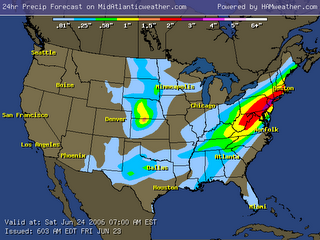
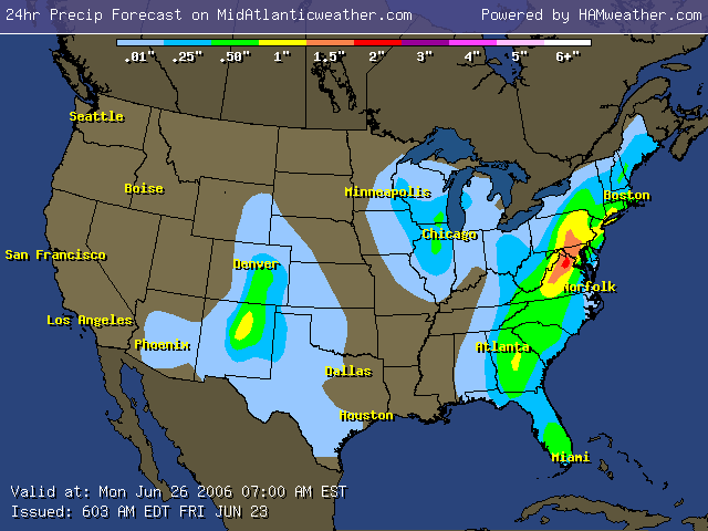
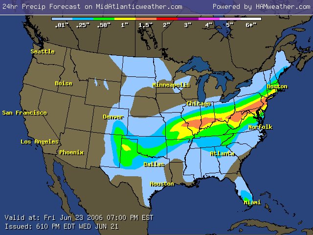
Here is the current 2 & 3 day analysis of rain:

By the way.. check out http://www.midatlanticweather.com if you have not in a while. Many updated links have improved speed and information available. The menu alone has over 250 links in it! Just added fire weather forecasts!

Tropics: 1 wave off the Southeast coast shows some interest, but upper winds do not seem favorable at this time!

Thanks to all who continue to post to the Forum. The community has grown to 45 members. http://www.midatlanticweather.com/bb3/

Did You Know? I send this update out semi regularly via email! To get it send and email to midatlanticweather-subscribe@yahoogroups.com I also send a Severe Weather Alert when we need it. To get it mid-atlanticweather-subscribe@yahoogroups.com I am considering a tropical only list as well.

Great Host! Vodahost – a plan you cannot beat!!! 24000 MB of space, unlimited domains, unlimited email accounts, unlimited MySqL! http://www.vodahost.com?a_aid=0048a41a

WxAlliance is transforming the way that weather information is available for websites! If you need weather information in a quick and reliable way, WxAlliance will surpass your expectations! http://www.wxalliance.com

Forecast text and graphics from National Weather Service. Mid Atlantic Weather com is not responsible for accuracy of these forecasts and may not be held liable for any damages caused by using this web site. Data may not be current therefore the user agrees to always rely upon official forecast products for their area provided by the National Weather Service.

Monday, June 19, 2006


Temps come down SLIGHTLY.. with more rough weather possible Thursday. Scattered storms will great the weekend, but there ius a signal of back to normal temps by next week

Summary: Thunderstorms today did prompt a severe weather alert. Areas in Northern Virginia and some of Maryland did see some high winds and hail. See the new storm reports page at http://www.midatlanticweather.com/cgi-bin/weather/hw3.cgi?config=&forecast=spcstormreport&when=today&usemap=

Pretty hot temps tomorrow and the next day.. even hotter Thursday but an increase in thunderstorm activity, some of which could turn severe! There will be a continued unsettled pattern until Sunday and a gradual cool down in temps. Normal to maybe even slightly below normal temps may stick for a while after this! Also, there are some signs of increased rain chances!

\ By the way.. check out http://www.midatlanticweather.com if you have not in a while. Many updated links have improved speed and information available. The menu alone has over 250 links in it! Just added fire weather forecasts!

Tropics: 2 waves show some interest, but upper winds do not seem favorable at this time!

Thanks to all who continue to post to the Forum. The community has grown to 45 members. http://www.midatlanticweather.com/bb3/

Did You Know? I send this update out semi regularly via email! To get it send and email to midatlanticweather-subscribe@yahoogroups.com I also send a Severe Weather Alert when we need it. To get it mid-atlanticweather-subscribe@yahoogroups.com I am considering a tropical only list as well.

Great Host! Vodahost – a plan you cannot beat!!! 24000 MB of space, unlimited domains, unlimited email accounts, unlimited MySqL! http://www.vodahost.com?a_aid=0048a41a

WxAlliance is transforming the way that weather information is available for websites! If you need weather information in a quick and reliable way, WxAlliance will surpass your expectations! http://www.wxalliance.com

Forecast text and graphics from National Weather Service. Mid Atlantic Weather com is not responsible for accuracy of these forecasts and may not be held liable for any damages caused by using this web site. Data may not be current therefore the user agrees to always rely upon official forecast products for their area provided by the National Weather Service.

Friday, June 16, 2006


Heat is returning! Long term we COULD see a pull back in temperatures as the heat ridge pulls westward!

Summary: The heat is back and humidity too! It had to eventually show up. As the Ridging in the east holds strong, so will dry weather. The good news for the plains states is that this will pump a lot of moisture to the drought areas of the Middle of the country! See Precip outlook by Clicking Here

Heat ridging makes the forecast in our neck of the woods easy. Temps in the 90s with lows 70s.. Real summer time weather! Check out the heat index forecast by Clicking Here

By the way.. check out http://www.midatlanticweather.com if you have not in a while. Many updated links have improved speed and information available. The menu alone has over 250 links in it!

Tropics: They have quieted down a bit. Check out the updated Tropical weather center off the main page! There will be a new site releasing soon devoted to as much tropical information as I possibly can fit into a page!

Thanks to all who continue to post to the Forum. The community has grown to 45 members. http://www.midatlanticweather.com/bb3/

Did You Know? I send this update out semi regularly via email! To get it send and email to midatlanticweather-subscribe@yahoogroups.com I also send a Severe Weather Alert when we need it. To get it mid-atlanticweather-subscribe@yahoogroups.com I am considering a tropical only list as well.

Great Host! Vodahost – a plan you cannot beat!!! 24000 MB of space, unlimited domains, unlimited email accounts, unlimited MySqL! http://www.vodahost.com?a_aid=0048a41a

WxAlliance is transforming the way that weather information is available for websites! If you need weather information in a quick and reliable way, WxAlliance will surpass your expectations! http://www.wxalliance.com

Forecast text and graphics from National Weather Service. Mid Atlantic Weather com is not responsible for accuracy of these forecasts and may not be held liable for any damages caused by using this web site. Data may not be current therefore the user agrees to always rely upon official forecast products for their area provided by the National Weather Service.

Tuesday, May 30, 2006

5/30 DC/MD/VA Weather Outlook


Trying to get back into the swing of things here! Summer arrived almost on schedule. Hazy hot and humid conditions continue today through Thursday. A cooler Friday and a potentially nice weekend on tap. Tomorrow marks the beginning of Hurricane season. It looks to be another active year.


Summary:  Man was that a great Memorial Day weekend. It got hot, but that is summer for ya and perfect line up with the pool opening! Temps will remain on the host side today! Humidity levels will creep up high enough to give heat indexes in the upper 90s for the first time this year! A slight chance of thunderstorms (normal for hot and humid days.) A better chance will come into play Thursday with showers possible even Friday. This weekend looks really great. I hope to have the tropical Weather center revamped over the next several days! Bear with me!


Thanks to all who continue to post to the Forum. Our Please join those who have so we can get good feedback and regional coverage. http://www.midatlanticweather.com/bb3/


Did you know? I send this update out somewhat regularly via email! To get it send and email to midatlanticweather-subscribe@yahoogroups.com I also send a Severe Weather Alert when we need it. To get it mid-atlanticweather-subscribe@yahoogroups.com


Need a Hosting Solution? My host is incredible. Now offering 12000 MB of storage and 300 GB of transfer a month, unlimited email addresses, ftp accounts, and unlimited number of domain names pointing to the same server,  I have found nothing better! Also, reliable as ever! http://www.vodahost.com?a_aid=0048a41a


Forecast thoughts are those of Mid Atlantic Weather and should never e used for official forecasts. Please rely on official forecasts by the National Weather Service or other agencies for life and property decisions. Mid Atlantic Weather com is not responsible for accuracy of these forecasts and may not be held liable for any damages caused by using this web site. Data may not be current therefore the user agrees to always rely upon official forecast products for their area provided by the National Weather Service.


Sunday, March 26, 2006

3/26/2006 DC/MD/VA Weather Discusssion

Cool conditions may meet an end! It looks like warmer air arrives starting Thursday. A chance that the storm next weekend may bring some storminess. Questions on whether cooler air returns.


Summary: A blocking pattern will continue the cooler air for a while longer, and then a strong Pacific origin Low will traverse the country and warm us up (like they did all winter). This may break us down and keep us warmer or may be brief. If it is brief, the warm air should still come back by then end of the following week. Meanwhile, we have a chance of a few showers this morning followed by a sunnier day for most. Temps a bit below normal. Tuesday could hold some shower activity, which is desperately needed! This looks to be the driest March on record unless we get some serious reversals. See some of the drought issues by clicking on drought on the main site or seeing the new board over at the forum: http://www.midatlanticweather.com/bb3


Looking at the long term for April.. if you compare to previous similar Aprils, after a similar March and a small La Nina type of pattern we should warm up!


Thanks to all who continue to post to the Forum. The community has grown to 44 members. http://www.midatlanticweather.com/bb3/


Did you know? I send this update out semi regularly via email! To get it send and email to midatlanticweather-subscribe@yahoogroups.com I also send a Severe Weather Alert when we need it. To get it mid-atlanticweather-subscribe@yahoogroups.com I am considering a tropical only list as well.


Great Host! Vodahost.. 12000 MB of space,  unlimited domains, unlimited email accounts! http://www.vodahost.com?a_aid=0048a41a


3/26/2006 DC/MD/VA Weather Outlook

Cool conditions may meet an end! It looks like warmer air arrives starting Thursday. A chance that the storm next weekend may bring some storminess. Questions on whether cooler air returns.


Summary: A blocking pattern will continue the cooler air for a while longer, and then a strong Pacific origin Low will traverse the country and warm us up (like they did all winter). This may break us down and keep us warmer or may be brief. If it is brief, the warm air should still come back by then end of the following week. Meanwhile, we have a chance of a few showers this morning followed by a sunnier day for most. Temps a bit below normal. Tuesday could hold some shower activity, which is desperately needed! This looks to be the driest March on record unless we get some serious reversals. See some of the drought issues by clicking on drought on the main site or seeing the new board over at the forum: http://www.midatlanticweather.com/bb3


Looking at the long term for April.. if you compare to previous similar Aprils, after a similar March and a small La Nina type of pattern we should warm up!


Thanks to all who continue to post to the Forum. The community has grown to 44 members. http://www.midatlanticweather.com/bb3/


Did you know? I send this update out semi regularly via email! To get it send and email to midatlanticweather-subscribe@yahoogroups.com I also send a Severe Weather Alert when we need it. To get it mid-atlanticweather-subscribe@yahoogroups.com I am considering a tropical only list as well.


Great Host! Vodahost.. 12000 MB of space,  unlimited domains, unlimited email accounts! http://www.vodahost.com?a_aid=0048a41a


Monday, March 20, 2006

A little snow. Not much!

Many north of a Fredericksburg to Charlottesville line up to Baltimore will see a little snow tomorrow. Ground temps will be warm. Expecting nothing more than a dusting to an inch or so.
 
There could be slightly more near Charlottesville and in the higher elevations.
 
2" would be the max for low elevations and not much will fall in Northern Maryland.
 
Hey.. it is Late March!
 
There is a slight possibility of another storm this weekend that could cause snow.. but I am not very confident in the idea and again higher elevations would see the real threat.
 
We need rain in the region as we are very, very dry!
 
 
Great School in Northern Virginia. http://www.ambleside.org

Sunday, March 19, 2006

Colder than normal temps + a southern storm= SNOWSTORM POSSIBLE!


Colder than normal temps + a southern storm= SNOWSTORM POSSIBLE!


Summary:  Wow! Here we go with another chance of snow! Anyone remember temps last weekend?  That is right! Give the weather a week and things can chage. The Combining features. A strong 1040MB High (Impressive this time of year) in Canada and a southern storm. So many things work against accumulating snow in areas east of the mountains this time of year!

  1. Warm ground
  2. Warm sun
  3. Long daylight hours
  4. Climatology


BUT.. there are exceptions to every situation! And this may be the exception! Right now, the most favored areas are higher elevations, especially north of Charlottesville. Higher elevations could see 3-6” and lower elevations 1-3”. Areas west of I-95 north of Fredericksburg to Charlottesville seem more likely to me than anywhere else to see snow (other than the mountains of course)


Longer term appears to remain below normal to near normal temps and continued dry.


Thanks to all who continue to post to the Forum. The community has grown to 44 members. http://www.midatlanticweather.com/bb3/


Did you know? I send this update out semi regularly via email! To get it send and email to midatlanticweather-subscribe@yahoogroups.com I also send a Severe Weather Alert when we need it. To get it mid-atlanticweather-subscribe@yahoogroups.com I am considering a tropical only list as well.


Great Host! Vodahost.. 12000 MB of space,  unlimited domains, unlimited email accounts! http://www.vodahost.com?a_aid=0048a41a


Forecast text and graphics from National Weather Service. Mid Atlantic Weather com is not responsible for accuracy of these forecasts and may not be held liable for any damages caused by using this web site. Data may not be current therefore the user agrees to always rely upon official forecast products for their area provided by the National Weather Service.


Great School in Northern Virginia. http://www.ambleside.org

Thursday, March 16, 2006

A little snow after 85 degree weather! Wow!

Later tonight in areas mainly North of Fredericksburg to Charlottesville and west of I-95 may see a bit of snow! Snow could set up in a narrow band and cause heavier accumulations (up to 3" on grassy areas in higher elevations), but mainly a dusting for most who see it.. Road and ground temperatures are pretty warm so this will not cause major issues except maybe some of the higher elevations.
 
Temperatures will remain cool through the weekend and another rain/snow mixing type scenario may unfold next week. That is iffy as of now.
 
85 degree temps to snow in 4 days! Wow!
 
All for now!
 
 
Great School in Northern Virginia. http://www.ambleside.org

Friday, March 03, 2006

3/3/2006 VA/DC/MD Weather Outlook


It has been a long while when I have done a general update. Nothing too exciting out there. Something to watch and then a real warm up possible as long as we do not get the dreaded Back Door cold front!


Summary:  This winter is destined to end above normal temperatures overall and below normal on snow, unless Monday’s system comes to rescue this. At this point I am not too bullish on snow hopes. The system will need to dig a bit more and form closer to the coast. There are factors pointing against a good accumulation. First it is during the day. Second we are marginal on temps, and third we are not super cold before it comes. All that being said, it is the last chance and it could surprise me! If it is going to it needs to really start showing on models today. As far as longer term, it appears the West Coast will have a deep trough a a big storm will affect the Front Range. This should mean a warm up in our area.. The only caveat would be a remnant high to the north that would cause an ocean front to cool us down. Not planning on it, but the pattern kind of reminds me of the scenario!  All for now!


Thanks to all who continue to post to the Forum. Our community has grown to 43 members and surpassed 10800 posts!.  Please join those who have so we can get good feedback and regional coverage. http://www.midatlanticweather.com/bb3/


Did you know? I send this update out somewhat regularly via email! To get it send and email to midatlanticweather-subscribe@yahoogroups.com I also send a Severe Weather Alert when we need it. To get it mid-atlanticweather-subscribe@yahoogroups.com


Need a Hosting Solution? My host is incredible. Now offering 12000 MB of storage and 300 GB of transfer a month, unlimited email addresses, ftp accounts, and unlimited number of domain names pointing to the same server,  I have found nothing better! Also, reliable as ever! http://www.vodahost.com?a_aid=0048a41a


Forecast thoughts are those of Mid Atlantic Weather and should never e used for official forecasts. Please rely on official forecasts by the National Weather Service or other agencies for life and property decisions. Mid Atlantic Weather com is not responsible for accuracy of these forecasts and may not be held liable for any damages caused by using this web site. Data may not be current therefore the user agrees to always rely upon official forecast products for their area provided by the National Weather Service.


Great School in Northern Virginia. http://www.ambleside.org

Share!


Share/Bookmark