Wednesday, October 24, 2012

Update on Storm for Sunday - Tuesday!

Due to extenuating circumstances I have not been able to update!

What I know:
  1. Sandy is a Hurricane and is strengthening steadily! The strength of her is an important ingredient in this situation.
  2. We are still days away! Models are shifting around but are converging on an East coast system/ hybrid Hurricane - exact details are tough, but it looks significant
  3. If things materialized this system will be a multi-punch system!
    1. Winds along coast and inland
    2. Very heavy rains, especially along coastal plains
    3. Storm surge and coastal flooding
    4. Heavy mountain snows - 12"+ amounts in higher elevations
  4. Where???? Based on model projection and, NOT YET a forecast -
    1. East of I-95 for areas of NC, VA, MD, Central PA, look bad
    2. DE, NJ, Eastern PA, NY, and MA look Severe!
  5. SO MANY variables so do not get locked in on details, but be prepared! Stay tuned for future updates!

All for now!


Friday, October 19, 2012

Clearing day and then Great week of weather ahead!

The storms and needed rains of last night are departing and there is some residual cloudiness and fog burning off, but the day looks to get better and better as it goes along with many in the 70s today.

Weekend looks great! Awesome site seeing time with so many trees in color! Highs will be in the seasonal 60s and nights in the 40s (cooler mountains)

Next week is as good of a forecast as you can get! Highs daily in the 70s and nights 40s and 50s. I am not seeing a rain chance until a week from Sunday!

Enjoy the weather. A strong front and cooler weather look likely the following week.

Awesome stuff!

Of note, a lot of model runs point to a Tropical system in the gulf next week. We will see!

All for now!

Thursday, October 18, 2012

Warm with a chance of Severe today!! Beautiful weekend! Very warm next year!

Risk of severe continues into the night. Again, the biggest risk is winds, but an isolated tornado could occur. The severe does not look widespread. Rain is more likely this afternoon and could last into the evening! Temps in the 70s and breezy conditions. Showers could linger into tomorrow morning and highs again tomorrow will reach the 70s.

This weekend looks great with highs in the 60s and clear skies!

Next week looks warm! A large storm will be advancing across the country and strong southerly winds should pump up the temps. That storm will arrive, probably next weekend and we should watch for another severe threat then, That will set the stage to a cool/cold spell for the following week. Long term I see this being a temporary cool down!

All for now!

Jimmy

Wednesday, October 17, 2012

Slight Risk of Severe Thursday! Seasonal Weekend! Warm next week!

The system that will be coming through could bring gusty winds in showers and storms!

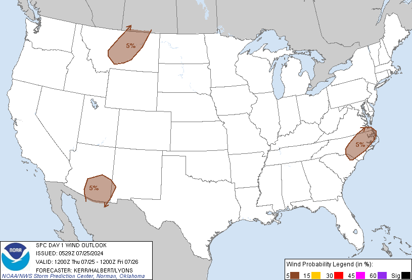
The SPC has highlighted good amount of the area with a slight risk. http://www.spc.noaa.gov/products/outlook/day2otlk_1730.gif

The weekend looks really nice! Fall like with colors at peak or close to it in the mountains! Go take a look and some photos!

Next week we look to really warm up. 70s will be widespread. A colder shot should visit after that, but it looks transient!

My winter forecast will be out by the end of the weekend!

All for now!

Slight risk of severe! Warmer next week!

The system that will be coming through could bring gusty winds in showers and storms!

The SPC has highlighted good amount of the area with a slight risk. http://www.spc.noaa.gov/products/outlook/day2otlk_1730.gif

The weekend looks really nice! Fall like with colors at peak or close to it in the mountains! Go take a look and some photos!

Next week we look to really warm up. 70s will be widespread. A colder shot should visit after that, but it looks transient!

My winter forecast will be out by the end of the weekend!

All for now!

Slight risk of Severe tomorrow! Seasonal weekend! Warm next week!

The system that will be coming through could bring gusty winds in showers and storms!

The SPC has highlighted good amount of the area with a slight risk. http://www.spc.noaa.gov/products/outlook/day2otlk_1730.gif

The weekend looks really nice! Fall like with colors at peak or close to it in the mountains! Go take a look and some photos!

Next week we look to really warm up. 70s will be widespread. A colder shot should visit after that, but it looks transient!

My winter forecast will be out by the end of the weekend!

All for now!

test

test

test

test

Slight severe risk tomorrow! Nice Weekend! Warmer next week!

The system that will be coming through could bring gusty winds in showers and storms!

The SPC has highlighted good amount of the area with a slight risk. http://www.spc.noaa.gov/products/outlook/day2otlk_1730.gif

The weekend looks really nice! Fall like with colors at peak or close to it in the mountains! Go take a look and some photos!

Next week we look to really warm up. 70s will be widespread. A colder shot should visit after that, but it looks transient!

My winter forecast will be out by the end of the weekend!

All for now!

Sunday, September 30, 2012

Brilliant fall weather has some interruptions of rain!

Today temps will be in the 70s and some showers are possible. Another cool night ahead with lows in the 40s and the 50s. Monday will see increasing clouds and rain overspreading from the south to the north. Highs will again be in the 70s. Showers will be light tomorrow and then some stronger rains Monday night and Tuesday. there is a risk for thunderstorms Tuesday.

By Wednesday things look to dry out and a continuation of temps in the 70s to near 80!

Next Weekend we may see a serious cool down with 30s even possible in the region! We will have to see!

All for now!

Friday, August 31, 2012

Hot end to summer - rains Sunday and Monday (and beyond)

Today it will be hot, but not too humid. The forecast has highs topping in the middle 90s. A good end to Meteorological Summer which was very hot and finally turned towards the end of July! Tomorrow looks pretty hot too with highs getting close to 90 and some humidity creeping its way in. Sunday into Monday moisture from Isaac will enhance a front that will stall somewhere in VA. Some areas into early next week will get 1 to 2 inches of rain from the system. As of now that looks like the Piedmont and mountain regions of NC and VA. Northern VA, MD and PA look more like a half inch to inch of rains set up. Areas overall could get more in thunderstorms. That front is going to linger around next week and provide at least a chance of showers through Wednesday when another front comes in and could enhance the rain threat. Some sunny days may follow. 80s seem to dominate the forecast highs starting Sunday and all next week. Towards the end of next week or next weekend, areas in Northern VA, DC, MD, PA could see highs staying in the 70s. Fall is coming!

All for now!


Tuesday, July 24, 2012

HOT today with Severe Threat! Slightly cooler for some tomorrow - More storms later this week

I do think that overall we are in a slow cool down trend and think the worst heat waves are pretty much done this year. That being said, a day or 2 of 90+ temps with high humidity is not unlikely for Northern VA, MD, and PA. Central VA will still have 90+ days as it is just climatology. But, in general, I think we head for cooler temps as a mean. Today is a hot one though! Temps will peak in the mid and upper 90s! Heat indexes will also be in the 100 - 105 degree range. We also have a threat of severe today. Some models had a derecho look to it and caused some alarm yesterday. I am concerned of a line of severe especially South of Fredericksburg down in to NC, or even a Meso Convective Complex (already see this heading to this area on national Radar) . Isolated to scattered strong storms do look possible throughout the region as a front comes through the north areas and and gets hung up in NC. That front will come back up north Thursday and Friday and continue chances for storms after a drier Wednesday for areas of Northern VA, MD, and PA. 

Today - we already have a line of racing storms that could come through later this morning in MD and North VA! Quick strong winds and heavy rains could accompany them. As mentioned - HOT!


Tomorrow, for the north will be less humid and a cooler day. Southern half could see some storms. 

Thursday, an increase in humidity and storm chances come back. Highs 90s area wide

Friday will feature a better chance of storms across all the region. Highs again around 90 north and low 90s south.

Saturday - More showers and storms possible. Highs 80s to low 90s.

Sunday - Drying up some - highs in the upper 80s to low 90s.


All for now!

Monday, July 23, 2012

Concerns rising over possible derecho tomorrow

Will watch!

It's Back! Heat, Humidity, chance of severe! Hello Monday!

So, we had a huge break from the heat this weekend, but it was not too far away and the winds shift today to make it come back! Humidity is also really high today. So the summer of 2012 continues its relentless grip. By now, I had thought El Nino would have kicked in to help quell the heat some. I do think the worst of summer may be over, but even the not so hot stuff of summer remains uncomfortable!
 
90s today and tomorrow. Temps will feel around 100 to 105. Over the next 24 hours there is a chance that some severe weather could affect us. Today this is especially true for MD and PA, but possibly even northern VA. Tomorrow it is region wide as a front comes through.
 
Temps and humidity back off some Wednesday but 90s and a chance of storms returns Thursday, Friday, and Saturday with highs in the 90s, maybe upper 80s north Saturday. There are also some meteorologists and models showing a chance of a more widespread severe event Thursday, Friday, or even Saturday. Will see if that pans out.
 
Tropics are pretty much calm, except a disturbance that drenched Florida yesterday which has dissipated today.
 
All for now!

Sunday, July 22, 2012

Sumertime pattern to return

The crazy thing of yesterday was that we were well below normal with temps after such a hot week. Yesterday DC and Baltimore had record low High temps! Last Wednesday, 100+ temps!
 
After today a warmer/hotter pattern returns with highs around 90 each day. Thunderstorm chances seem possible each day and there is concern that sometime between Thursday and Saturday there could be a real severe weather outbreak in the northeast and mid Atlantic.
 
So a typical summer week with a chance of late week severe!
 
I cannot rule out some severe tomorrow either based on some parameters in the set up.
 
All for now!


Tuesday, July 17, 2012

Another day around 100| Nicer weather Friday through the weekend

We see a day of clear but hazy skies and temps nearing the century mark again! It has been a rough summer and the drought is not looking good for food prices! Not much of  risk of any storms today, except maybe the mountains as they seem to be able to eek out a few storms on days like today. Along and east of I-95, temps of nearly 100 will cause more records to tie or fall!
 
Wednesday is a bit tricky. PA and N MD could be seeing some storms towards daybreak and these storms could become more scattered through the area as a front slowly sinks southward. Depending on cloud cover areas will likely again see highs into the mid and upper 90s, but this time with a bit more moisture which could mean some heat advisory (105 feels like temps). The convection that does fire tomorrow could become severe in spots and definitely could contain very heavy rains. All should be monitored.
 
Thursday looks cloudy north with scattered showers and storms as the front slowly sinks south. Southern VA and NC look most primed for severe, but heavy local rains still looks possible.
 
Storminess will exit the North, but southern VA and NC should still have some showers and storms Friday and even Saturday in NC. Temps north of the front will have dropped to the mid and upper 80s and lower dew points which look to last through the weekend! NC will remain a bit of a battle zone so Northern NC could be nice and dry why southern areas see some storminess and warmer temps, and even the chance for really heavy rains.
 
Temps return to the 90s most regions by Monday!
 
All for now!


Monday, July 16, 2012

Wild storms yesterday|Clearing but HOT skies ahead! Cooler late in week

Yesterday featured quite a few storms and some produced some awesome shelf clouds. Check out WTVR 6 picture round up http://wtvr.com/2012/07/15/storm-pics-from-sunday-july-15/
 
Today starts several days of uncomfortable highs in the 90s and high humidity. Storm chances look best along ridges and along the coastal areas, and more towards the NC area.
 
Highs Tuesday look down right HOT with temps nearing 100 and heat indexes again climbing to 105 or higher in cities. Heat advisories yet again will be issued.
 
Wednesday a front will make its way through the area. This will bring down the temps in the north, but the humidity may be able to offset the cooler temps. Showers and storms will become more numerous with the chance of some severe. That front will continue pushing to the south but make slower progression across the southern half of VA and for NC. So that means a good chance of more showers and storms Thursday for these regions. Then the Front moves further south, giving NC one more day of stormy weather, but VA will be sitting cooler with less humidity Friday.
 
The whole region looks nice and seasonal temperature wise this weekend with lower humidity. I have a feeling we will see the return of the warmth next week, so do not get too used to it!
 
All for now!


Sunday, July 15, 2012

Soupy! Hot and Humid with Local downpours!

The hazy hot and humid weather is here at least through Wednesday. With weaknesses in the Bermuda high some chances exist each day for rain and some could be very heavy. Please do not drive through water! Your life and property are too valuable.

Temps will be in the low and mid 90s today, then mid and upper 90s through Wednesday. Storms will be scattered about today and less likely Monday and Tuesday. A better chance returns Wednesday.

Later in the week the temps will come down a bit and a little less humidity.

Temps around 90 will be the common rule after Wednesday, but before then, temps will be around 100 degrees!

Jimmy

Friday, July 06, 2012

Just so hot - then a break - severe potential Sunday

With subsiding (sinking) air we will see temps really soar today and tomorrow. Isolated locations could see crazy high temps tomorrow of even 105 or higher as sinking air can warm localities even higher than what we think in the forecast and can be isolated hot pockets (queue Jim Gaffigan) around. Does it matter - NO - it is gonna be downright super hot!

Sunday will see the approach of a cold front with cooler air on the other side. The clash of the air masses will definitely mean a chance for severe weather and so we need to stay alert.

Next week looks like a break! Temps will go back to seasonal norms of the mid and upper 80s and then by later in the week even some low and mid 80s. Due to instability a chance of afternoon thunderstorms occurs across the region Monday and across the southern ha;f of the region straight through the end of the week.

Enjoy the break as it does look brief! Temps will rise again before too long as the global weather pattern seems to favor a hotter forecast. This is quite different than I had first thought for summer as it appeared El Nino would be showing up by now, but it has not established itself yet!

All for now!


Share!


Share/Bookmark