Temps will likely peak this AM across the North and then fall under gusty winds. Temps will struggle to the he low and mid 60s north, but manage the 70 to 75 degree mark south.
A cold night will bring Frost and Freeze concerns to the mountains and valleys and even lower elevations of Northern VA, MD, PA, NJ. Temps in PA and some valley and mountains could hit the 20s and low 30s elsewhere in these regions. 30s elsewhere with low 40s south. Tomorrow will be the first seasonable day in weeks with highs in the 50s for the most part - closer to 50 north and upper 50s south.
We bounce back strongly Wednesday with highs soaring again to the 70s, to close to 80 south. A fairly strong front will cross the region Wednesday with the threat of severe possible based on some dynamics that will have to be watched. This will front will bring slightly cooler air again but temps will remain 5 to 10 degrees above normal.
Dry conditions after Wednesday may last through next Monday. Then we have something odd to watch Early next week - there could be a New England inland snow and a cold few days to content with.
All for now.
Get that Crabgrass preventer down. Do it yourself or get my friend at Lawn Design to do it. http://www.lawndesignva.com
Monday, March 26, 2012

Friday, March 23, 2012
Warm Friday will turn to a cooler rainy weekend
Today,after morning fog, a warm and sunny day will mark the end of the truly warmer weather. Highs in the 80s.
Rain and quite a bit of it for the weekend. Highs will cool to the 60s and steady to occasionally heavy rain will fall with
1 to 3 inches fairly common. Some severe also seems possible tomorrow for most of Southern VA and NC. Rain will continue Sunday.
More later concerning severe and flood threats.
Monday, March 19, 2012
Isolated Showers and #Thunderstorms today| 70s all week|Saturday rain
Today will feature scattered to isolated showers and some Thunderstorms. Highs will be in the 70s.
Showers and storms will continue to be a threat across the southern half of Virginia and North Carolina tomorrow, and across the VA/NC border into North Carolina all week.
High will be low and mid 70s north and mid 70s to around 80 south.
Another chance of widespread showers and storms hits Saturday.
If in the DC area the Cherry Blossoms will peak within the next 2 days (probably tomorrow).
Tomorrow at 1:14 AM ET, Astronomical Spring begins!
All for now!
Sunday, March 18, 2012
Did not ever Share, how this #winter compared to others in DC Area!
...AVG TEMPS THIS METEOROLOGICAL WINTER...
DCA...43.4F RANKS 3RD WARMEST WINTER ON RECORD /BEHIND 44.6F IN
1931-32 AND 44.3F IN 1889-90.
BWI...40.7F RANKS 7TH WARMEST WINTER ON RECORD /45.3F IN 1931-32 IS
THE WARMEST/...AND THE WARMEST WINTER SINCE 1949-50.
IAD...40.1F RANKS WARMEST ON RECORD...WHICH BREAKS THE PREVIOUS
WARMEST WINTER OF 39.8F SET IN 2001-02
DCA...43.4F RANKS 3RD WARMEST WINTER ON RECORD /BEHIND 44.6F IN
1931-32 AND 44.3F IN 1889-90.
BWI...40.7F RANKS 7TH WARMEST WINTER ON RECORD /45.3F IN 1931-32 IS
THE WARMEST/...AND THE WARMEST WINTER SINCE 1949-50.
IAD...40.1F RANKS WARMEST ON RECORD...WHICH BREAKS THE PREVIOUS
WARMEST WINTER OF 39.8F SET IN 2001-02
#fog to start|Hazy sunshine possible later| Storms possible South and West|Storms tomorrow
Anyone that is getting the easterly winds from the backdoor front is seeing a foggy start this AM. Temps have cooled to the low and mid 50s for most, but 40s showing up for areas near the ocean or bay. Highs today could be a bit cooler for folks due to the haze and fog today, but still at least 10 to 15 degrees above normal. There could be some showers over SW Virginia and western NC.
Scattered showers and storms will visit the whole region tomorrow with highs pretty close to today's but maybe a few degrees warmer due to southerly winds. Tuesday looks to continue a chance for showers and storms to the south (southern half of VA and NC) Temps again in the 70s.
Rest of the week looks to stay in the 70s and fairly dry until Friday Night and Saturday when the next set of showers and storms could enter the area.
For the fun fact in weather today, Anchorage, AK is 3.3" short of establishing the snowiest season on record. http://articles.boston.com/2012-03-17/news/31205384_1_snow-disposal-sites-city-crews-arctic-oscillation
All for now!
Saturday, March 17, 2012
Regional Weather today - Sun North - chance of showers and storms south!
Northern VA, Central VA, MD, PA-
Today and tomorrow will be pleasantly warm in the north areas with sun and highs in the upper 60s to low and mid 70s.
Southwestern VA, and areas along the NC/VA border and into NC-
Highs mid 70s with a chance of shower and storms straight through tomorrow.
Showers and storms look to be area wide Monday.
Storm chance will continue over southern VA and NC Tuesday. All areas look dry then through Friday with temps ranging from about 70 north to the upper 70s south!
All still looking about 20 degrees above normal!
All for now!
Get that Lawn some St Patrick's Day Green! reach out to http://www.lawndesignva.com today!
Today and tomorrow will be pleasantly warm in the north areas with sun and highs in the upper 60s to low and mid 70s.
Southwestern VA, and areas along the NC/VA border and into NC-
Highs mid 70s with a chance of shower and storms straight through tomorrow.
Showers and storms look to be area wide Monday.
Storm chance will continue over southern VA and NC Tuesday. All areas look dry then through Friday with temps ranging from about 70 north to the upper 70s south!
All still looking about 20 degrees above normal!
All for now!
Get that Lawn some St Patrick's Day Green! reach out to http://www.lawndesignva.com today!
Thursday, March 15, 2012
Record heat - thunderstorms for Friday - Bit cooler for weekend - Heat comes back next week!
Today we will see a record setting day of high temperatures! So far in the last few days 835 record High Temperatures have been recorded. We will see many more today in the Mid Atlantic as temps spike to around 30 degrees above normal. Later this afternoon showers and storms could get going in the western areas especially west of the mountains. Overnight that spreads east and scattered showers and storms will be firing throughout Friday and into Friday evening. Temps will likely be about 10 to 15 degrees tomorrow and then maybe a few degrees cooler Saturday. Still WAY above normal. Temps will be in the low and mid 70s Saturday and in the Mid an upper 60s Sunday. Do not fret as the heat wave will continue next week as temps again soar into the 70s!
Seriously, get your Crabgrass preventer ASAP. Get in touch with my friend Dave at Lawn Design. I am doing this as a favor to him. http://www.lawndesign.com
All for now!
Jimmy
Seriously, get your Crabgrass preventer ASAP. Get in touch with my friend Dave at Lawn Design. I am doing this as a favor to him. http://www.lawndesign.com
All for now!
Jimmy
Wednesday, March 14, 2012
#record #warmth to remind us of Summer
The temps are going to soar to the low and mid 80s for many the next 2 days! Amazing warmth and many records will likely topple! We have an increasing chance of Showers and storms, starting tomorrow and then again Friday. This will cool us down to the 70s for the weekend (almost 20+ degrees above normal)
Did Spring sneak up on you? Well, if you are not careful the Crabgrass will too! Please reach out to my friend Dave at Lawn Design and get your pre-emergent crabgrass preventer down TODAY!
All for now!
Monday, March 12, 2012
Spring has sprung this week!
What a pleasant stretch of weather! Highs will be in the upper 60s to low 70s today, and then 70s the rest of the week! Highs may approach 80 Thursday and Friday. Showers tonight and then a chance of showers and thunderstorms tomorrow! Another rain chance Friday night into Saturday!
Spring for sure!
Jimmy
Spring for sure!
Jimmy
Monday, March 05, 2012
On the cusp of #Spring
First off the huge snow today! WOW! Guys, that was A HUGE miss by me.. I had downplayed the event in my mind so much that I was just not on top of it at all! I was then in meeting most of the day, and, since weather cannot make me money, I could not neglect the job!
Amazing reports from Orange County of 8 to 10 inch snows. A heavy band set up and just snowed and snowed! Awesome for them, although I heard driving was a nightmare and many kids were at school! http://www.erh.noaa.gov/er/lwx/events/snowmaps/
So we get really cold tonight with lows around 20 in the suburbs, even teens, especially if you have any snow pack! Colder than normal one more day and then a jump in temps! Highs in the 40s tomorrow to around 60 Wednesday, to 65 to 75 Thursday!
Temps cool to the 50 Friday and Saturday, but rebound again Sunday!
Looking at the long term maps, warmth is shown to overspread, not just the US, but into Canada! That is a good sign for Spring!
For the greenest lawns in the world, check out Lawn Design in Central and Eastern Loudoun County VA! http://www.lawndesignva.com
All for now!
Amazing reports from Orange County of 8 to 10 inch snows. A heavy band set up and just snowed and snowed! Awesome for them, although I heard driving was a nightmare and many kids were at school! http://www.erh.noaa.gov/er/lwx/events/snowmaps/
So we get really cold tonight with lows around 20 in the suburbs, even teens, especially if you have any snow pack! Colder than normal one more day and then a jump in temps! Highs in the 40s tomorrow to around 60 Wednesday, to 65 to 75 Thursday!
Temps cool to the 50 Friday and Saturday, but rebound again Sunday!
Looking at the long term maps, warmth is shown to overspread, not just the US, but into Canada! That is a good sign for Spring!
For the greenest lawns in the world, check out Lawn Design in Central and Eastern Loudoun County VA! http://www.lawndesignva.com
All for now!
#snow impacting most of VA!
Snow has made it over most of Virginia - Heaviest bande along the Charlottesville - Frericksburg area as this seems to be the are just north of teh main low - 4 - ^' of snow there! 1-4" elsewhere south down to Richmond - Winter's last grasp!
60s and 70s expected Thursday and Friday!
60s and 70s expected Thursday and Friday!
Sunday, March 04, 2012
#Snow in the forecast - especially central VA
We will have a cooler day with highs in the 40s to close to 50 in the south. It will be cloudy. Some areas along the coast are seeing rain showers as well.
Tonight we start to see a clipper's influence and areas from Roanoke to Charlottesville and across the central part of VA could see 1 to 2" of snow with some local amounts near 3" in higher elevations. Areas across the southern half of VA may see some flakes and maybe up to 1/2" of snow on the grassy areas! Pinpointing the highest snow band has been a bit of a challenge. Highs tomorrow will only be in the low and mid 40s for many. Areas up to the MD/VA border MAY see a few flakes, but not much precipitation north of teh Fredericksburg area. May be able to put out a map later today. In general, higher elevations to see the higher 1-2" and on grass. Also, areas where snow starts before sunrise. Also, snow is not forecast to shift northward up into the MD and DC areas at this point.
After the cold Monday, some warming Tuesday by about 10 degrees, another 10 for Wednesday, and then 5 degrees of so for Thursday and Friday as temps soar to the mid 60s and mid 70s.
Rain and a bit cooler for the weekend.
Jimmy
Saturday, March 03, 2012
Rains ends - cooler - #snow showers and then back to Spring!
Thoughts and prayers to the hundreds that were affected by yesterday's major outbreak. 95 Tornado reports and at least 31 deaths so far. A serious day and it is amazing to have had so many so early.
The Mid Atlantic will see rain slowly winding down. Eastern NC and SC still seeing serious amounts of rain and the chance for severe. Please be careful down there.
The weather dries out and temps will fall this afternoon in the west and breezy conditions increase. Cooler days tomorrow with highs in the 50 to 55 degree range. The odd issue is that we will see a chance of snow showers Sunday Night into Monday morning for most of Virginia and Maryland. Temps in the 40s to low 50s Monday, 50 to 55 Tuesday, Mid 50s to mid 60s Wednesday, and then mid 60s to mid 70s by Thursday and Friday. After Monday we will see dry conditions!
All for now!
The Mid Atlantic will see rain slowly winding down. Eastern NC and SC still seeing serious amounts of rain and the chance for severe. Please be careful down there.
The weather dries out and temps will fall this afternoon in the west and breezy conditions increase. Cooler days tomorrow with highs in the 50 to 55 degree range. The odd issue is that we will see a chance of snow showers Sunday Night into Monday morning for most of Virginia and Maryland. Temps in the 40s to low 50s Monday, 50 to 55 Tuesday, Mid 50s to mid 60s Wednesday, and then mid 60s to mid 70s by Thursday and Friday. After Monday we will see dry conditions!
All for now!
Friday, March 02, 2012
Rain has quickly overspread area!
Look for rain and embedded thunderstorms rest of the day, tonight, and first half of tomorrow!
All for now!
All for now!
Rain and Thunder & Severe Chances next 24 hours - Brief cool down to follow!
Cloudy skies will spread over the region today with showers and storms on the increase from the west. Some storms have already fired in SC and NC and that will continue on that line as it moves north and east.
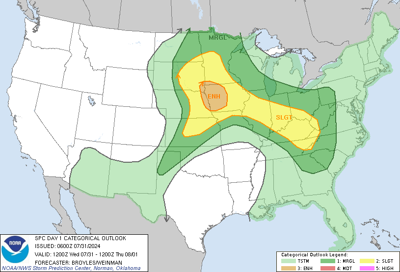
SPC has highlighted the western half of VA, MD, NC, and SC for a slight risk of severe. Be alert to radio and news outlets for potential watches and/or warnings. - Of Note, a moderate risk is there for the far SW part of the state of VA and a stripe of Western WV - http://www.spc.noaa.gov/products/outlook/day1otlk_1200.gif
Showers and storms will blow through overnight with breezy conditions. Lows will not be much colder than today's highs of 50s and 60s.
Breezy conditions continue tomorrow with improving conditions in the afternoon after morning showers and storms, especially in the east. Temps will climb some and then fall again as the day progresses. Sunday will be about 5 to 10 degrees cooler. Then another cooler day Monday with highs only to the mid 40s north and mid 50s south.
Temps will then step up Tuesday by 5 degrees and Wednesday by another 5 to 10 degrees until Thursday when highs in the 60s and even low 70s visit with dry conditions expected!
All for now!
SPC has highlighted the western half of VA, MD, NC, and SC for a slight risk of severe. Be alert to radio and news outlets for potential watches and/or warnings. - Of Note, a moderate risk is there for the far SW part of the state of VA and a stripe of Western WV - http://www.spc.noaa.gov/products/outlook/day1otlk_1200.gif
Showers and storms will blow through overnight with breezy conditions. Lows will not be much colder than today's highs of 50s and 60s.
Breezy conditions continue tomorrow with improving conditions in the afternoon after morning showers and storms, especially in the east. Temps will climb some and then fall again as the day progresses. Sunday will be about 5 to 10 degrees cooler. Then another cooler day Monday with highs only to the mid 40s north and mid 50s south.
Temps will then step up Tuesday by 5 degrees and Wednesday by another 5 to 10 degrees until Thursday when highs in the 60s and even low 70s visit with dry conditions expected!
All for now!
Monday, February 27, 2012
Very nice day! Rains Wednesday and Saturday!
It is going to be a beautiful day! Highs in the upper 50s to low 60s and sun! Tomorrow will not be as warm with highs low 50s north and upper 50s south. Then Wednesday there will be a potent system to our north with plenty of gulf moisture feeding it and causing widespread rain. There is a slight chance that as the precip starts a bit of sleet is mixed in, but rain will be the deal that day and colder temps of 40s and low 50s.
Thursday and Friday look seasonal with highs in the 50s. Friday night and Saturday more rain, maybe even some thunderstorms in the southern areas, will be possible. Temps will remain the same, but a chance of showers through the weekend.
All for now!
Thursday and Friday look seasonal with highs in the 50s. Friday night and Saturday more rain, maybe even some thunderstorms in the southern areas, will be possible. Temps will remain the same, but a chance of showers through the weekend.
All for now!
Saturday, February 25, 2012
Comb over Advisory in effect! Cold winds today - snow showers - Mild ALL next week!
The cold winds will persist today, but not quite as strong as yesterday. The winds will make it feel like it is in the 30s and low 40s most of the day though highs should make it to the mid and upper 40s north and around 50 south! With dry air and windy conditions the fire danger, especially in NC, is higher than normal and Red Flag Warnings are posted due to this. Please be careful.
I should mention that there is some instability today so a brief snow shower cannot be ruled out. This will be a bit more common on the upslope snow areas.
Winds subside overnight with lows in the 20s and low 30s.
Temps will come up a few degrees tomorrow with sunny skies.
Temps will jump upwards 10 degrees Monday to the mid and upper 50s to lower 60s! That temperature set up will last ALL WEEK! We will have rain chances Wednesday to deal with, but, otherwise, temps mid 50s to mid 60s area wide!
All for now!
I should mention that there is some instability today so a brief snow shower cannot be ruled out. This will be a bit more common on the upslope snow areas.
Winds subside overnight with lows in the 20s and low 30s.
Temps will come up a few degrees tomorrow with sunny skies.
Temps will jump upwards 10 degrees Monday to the mid and upper 50s to lower 60s! That temperature set up will last ALL WEEK! We will have rain chances Wednesday to deal with, but, otherwise, temps mid 50s to mid 60s area wide!
All for now!
Friday, February 24, 2012
Moderate Risk for Severe VA, NC, SC - High Winds
With Spring Like temps and a serious contract in temps and a strong cold front, the ingredients have come together to lift the severe threat to moderate for SE VA, NC, and SC. (http://www.spc.noaa.gov/products/outlook/day1otlk_1300.gif)While there is a risk for high winds, quick hitting tornadoes could also occur in these areas. In general, a very windy day looks to occur with winds along the higher terrain going to 60 mph or higher at times. Elsewhere, winds in the 40s to around 50 mph could occur. This is a day that you will need to pay attention to the weather and not take it for granted. The Weather Channel has even upped their Tornado index to 4 in the SE VA, Eastern NC, the DELMARVA, and Eastern SC areas.
Delmarva Peninsula - 4
Southeast VA - 4
Eastern & central NC - 4
Eastern & central SC -
Eastern & southern GA -3
Other red areas - 2
Tornado watches already up in GA, and SC... just saw a tornado warning for Russel County, VA. Busy severe day ahead!
See http://www.weather.com/outlook/weather-news/news/articles/daily-torcon-forecast_2011-07-11 for more details!
Temps today will soar into the 70s before the front crashed through this afternoon with severe storms and very gusty winds.
After today, a much cooler weekend is in store with highs in the 40s to low 50s Winds will also be an issue for Saturday.
I will leave next week open as the next 12 to 15 hours will keep me plenty busy!
Stay tuned to news and weather outlets for watches and warnings today!
All for now!
While)
Delmarva Peninsula - 4
Southeast VA - 4
Eastern & central NC - 4
Eastern & central SC -
Eastern & southern GA -3
Other red areas - 2
Tornado watches already up in GA, and SC... just saw a tornado warning for Russel County, VA. Busy severe day ahead!
See http://www.weather.com/outlook/weather-news/news/articles/daily-torcon-forecast_2011-07-11 for more details!
Temps today will soar into the 70s before the front crashed through this afternoon with severe storms and very gusty winds.
After today, a much cooler weekend is in store with highs in the 40s to low 50s Winds will also be an issue for Saturday.
I will leave next week open as the next 12 to 15 hours will keep me plenty busy!
Stay tuned to news and weather outlets for watches and warnings today!
All for now!
Wednesday, February 22, 2012
The Mild up continues - Few showers - NC/SC Severe threat!
Remember that a few days ago we were dealing with a Snow storm in parts of the region! Today widespread 50s and 60s! Some places this morning for low temps were nearly 20 degrees warmer! You ain't seen nothing yet! Forecasts for places like Raleigh, NC will see 75 degrees tomorrow! They had SNOW Sunday! Or Lynchburg, VA that had 7" of snow will see 71 tomorrow! CRAZY!
Due to the moist air mass a few showers cannot be ruled out later today. Shoot SPC shows a Thunderstorm risk for parts of VA, NC, and SC and even a severe risk in Western NC and SC! Showers are more likely and especially this evening up north. Tomorrow is the "Warm" day will mid 60s to mid 70s possible area wide.
A convoluted set up occurs Friday into Saturday with a cold front that will knock temps back down and also provide some good rains! We will need to watch again for a severe threat Friday, but, as of now, it appears and Eastern NC and SC risk.
HPC has the following 5 day Precipitation map:
http://www.hpc.ncep.noaa.gov/qpf/p120i12.gif
This is lighter than their earlier prediction.
SPC is highlighting the possibility of severe in western NC and SC:
http://www.spc.noaa.gov/products/outlook/day1otlk_1300.gif
It is like Spring.
MUCH cooler this weekend with highs back into the 40s and 50s.
All for now!
Due to the moist air mass a few showers cannot be ruled out later today. Shoot SPC shows a Thunderstorm risk for parts of VA, NC, and SC and even a severe risk in Western NC and SC! Showers are more likely and especially this evening up north. Tomorrow is the "Warm" day will mid 60s to mid 70s possible area wide.
A convoluted set up occurs Friday into Saturday with a cold front that will knock temps back down and also provide some good rains! We will need to watch again for a severe threat Friday, but, as of now, it appears and Eastern NC and SC risk.
HPC has the following 5 day Precipitation map:
http://www.hpc.ncep.noaa.gov/qpf/p120i12.gif

This is lighter than their earlier prediction.
SPC is highlighting the possibility of severe in western NC and SC:
http://www.spc.noaa.gov/products/outlook/day1otlk_1300.gif

It is like Spring.
MUCH cooler this weekend with highs back into the 40s and 50s.
All for now!
Tuesday, February 21, 2012
Going to get "warm" Thursday!
Real quick updates.
Few Showers possible later today and overnight. Temps 50s
mild and 50s tomorrow.
Almost WARM Wednesday and Thursday as high soar into the 60s ans some 70s possible! Mid 70s Central and Southern VA down into NC!
Then we have a chance for Showers and Thunderstorms Friday with cooler temps for the weekend.
All for now!
Few Showers possible later today and overnight. Temps 50s
mild and 50s tomorrow.
Almost WARM Wednesday and Thursday as high soar into the 60s ans some 70s possible! Mid 70s Central and Southern VA down into NC!
Then we have a chance for Showers and Thunderstorms Friday with cooler temps for the weekend.
All for now!
Subscribe to:
Posts (Atom)
Share!
